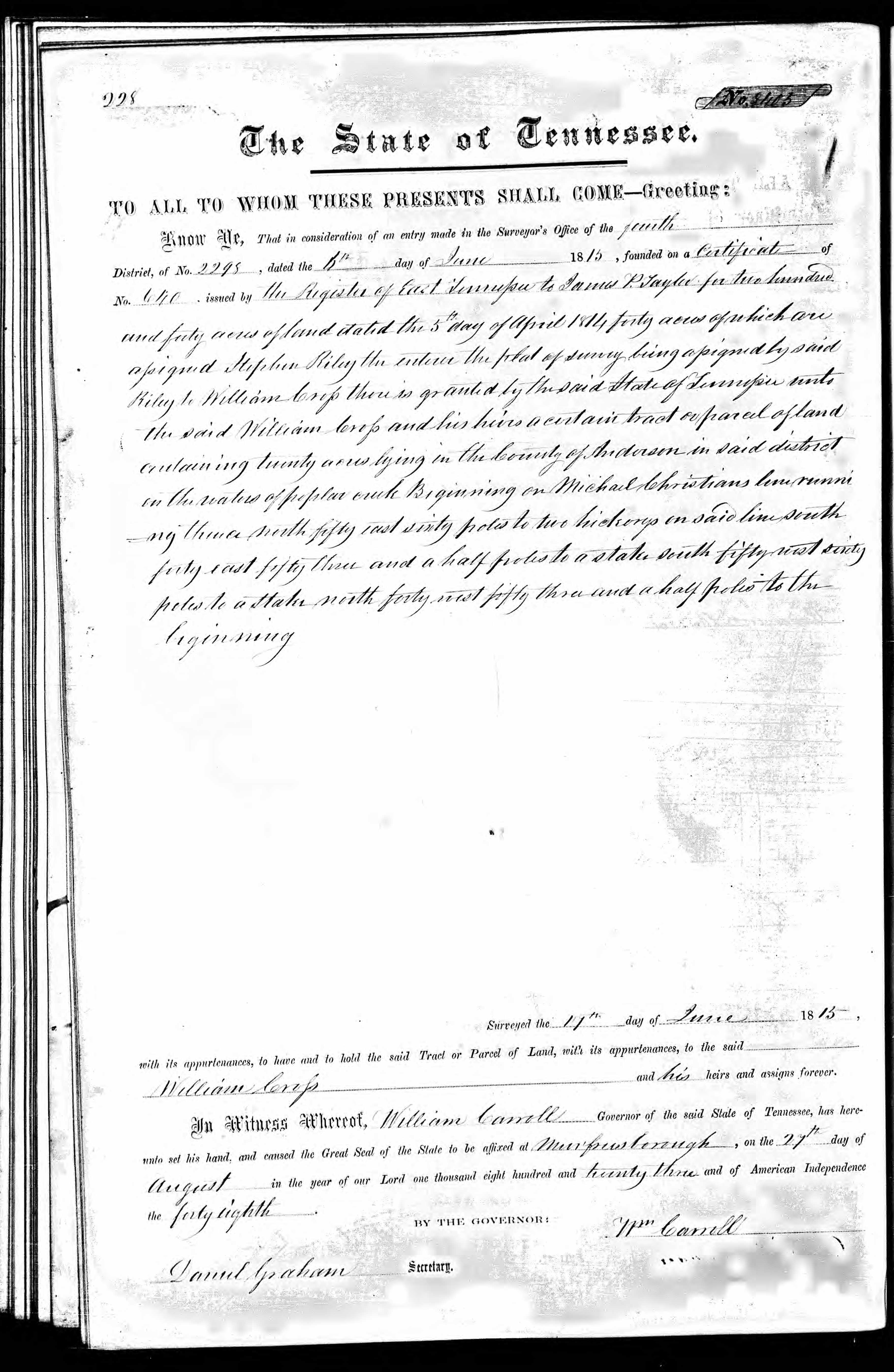
page 228, E Dist, Book 7 No. 8405
The State of Tennessee
To All to Whom These Presents Shall Come - Greeting:
Know Ye, That in consideration of an entry made in the Surveyor's Office the fourth
District of No 2295, dated the 6 day of June 1815, founded on a Certificate of
No. 640, issued by the register of East Tennessee to James P. Taylor for two hundred
and forty acres of land dated the 5th day of April 1811, forty acres of which are
assigned Stephen Riley enterer His part of survey being assigned by said
Riley to William Cross there is granted by the said State of Tennessee unto
the said William Cross and his heirs a certain tract or parcel of land
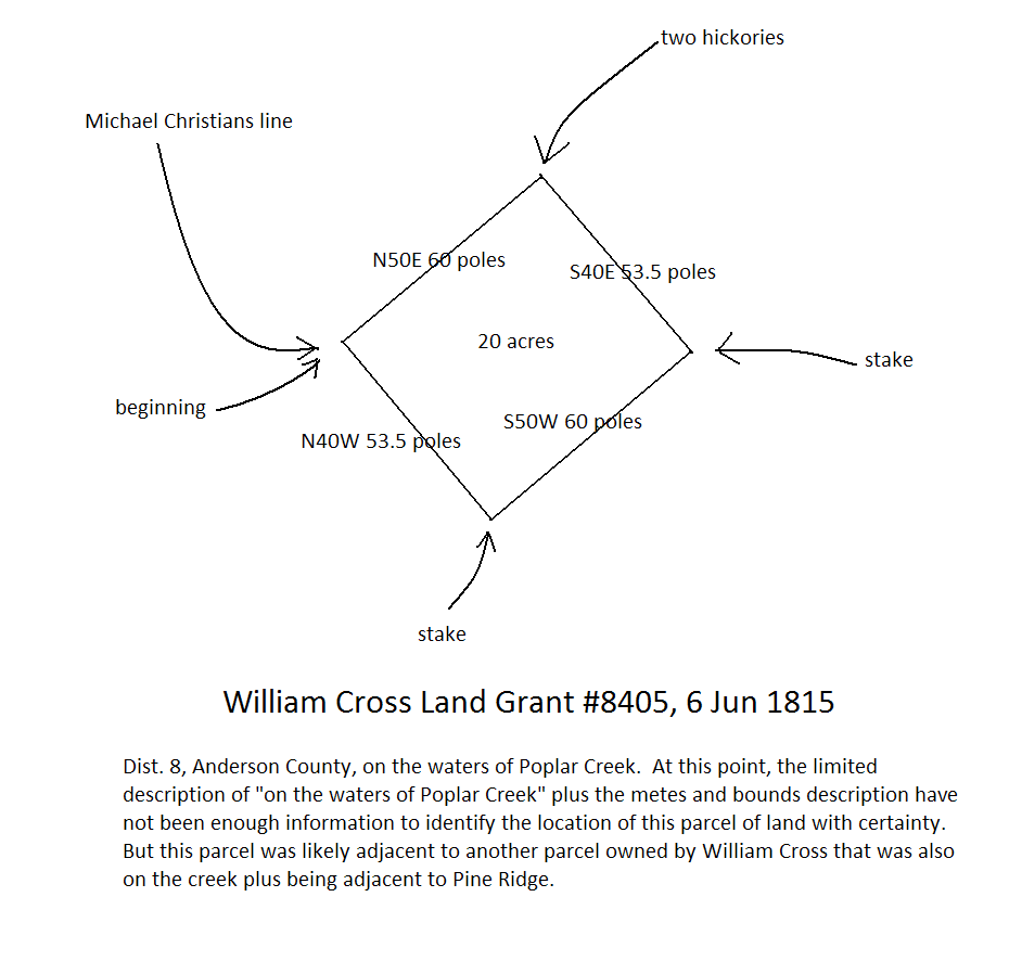
containing twenty acres in the County of Anderson in said district
on the waters of Poplar creek. Beginning on Michael Christians line runni
ng thence north fifty east sixty poles to two hickorys in said line south
forty east fifty three and a half poles to a stake south fifty west sixty
poles to a stake north forty west fifty three and a half poles to the
beginning.
Surveyed the 17th day of June 1815
with its appurtenances, to have and to hold the said Tract or Parcel of land, with its appurtenances to the said
William Cross ...........................................................and his heirs and assigns forever.
In witness whereof, William Carroll Governor of the said State of Tennessee, has here-
unto set his hand and caused the Great Seal of the State to be affixed at Murfreesborough, on the 27th day of
August in the year of our Lord one thousand eight hundred and twenty three and of American Independence
the forty eighth.
By the Governor
Wm Carroll
Daniel Graham Secretary
This 20 acre parcel of land was one of four parcels owned by my fourth great grandfather William Cross in Dist. 8 of Anderson County, Tennessee. The four parcels totaled 174 acres. These 174 acres have been the key to unlocking the identities of William's children.