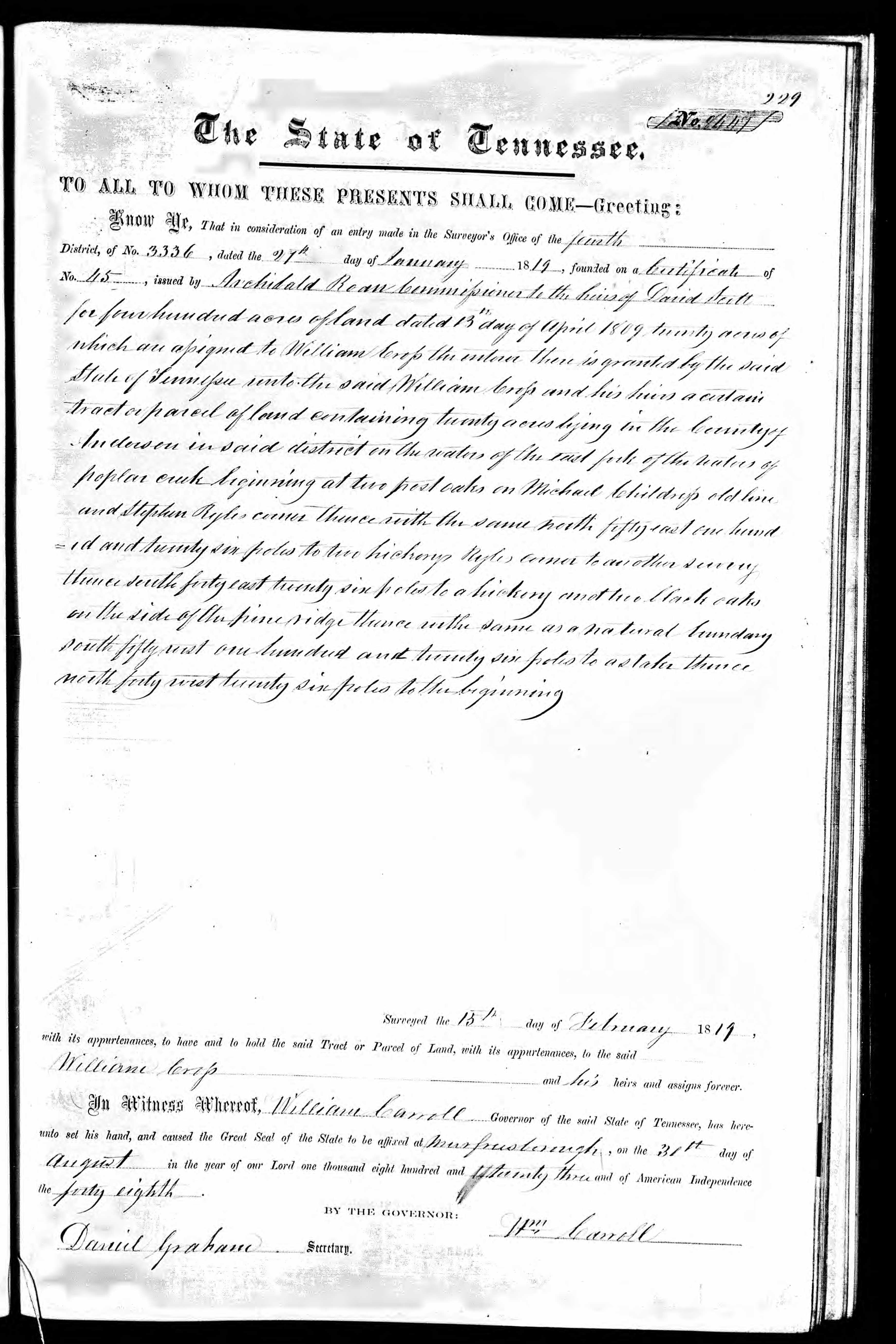
page 229, E Dist, Book 7 No. 8447
The State of Tennessee
To All to Whom These Presents Shall Come - Greeting:
Know Ye, That in consideration of an entry made in the Surveyor's Office the fourth
District of No 3336, dated the 27th day of January 1819, founded on a Certificate of
No. 45, issued by Archibald Roan Commissioner to the heirs of David Jett
for four hundred acres of land dated 13th day of April 1809 20 acres of
which are assigned to William Cross the enterer there is granted by the said
State of Tennessee unto the said William Cross and his heirs a certain
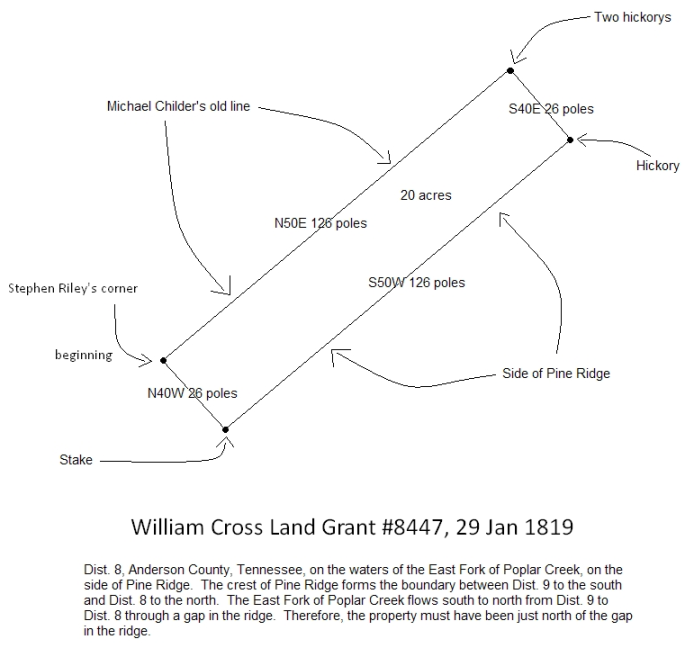
tract or parcel of land containing twenty acres in the County of
Anderson in said district on the waters of east fork of
Poplar creek beginning at two post oaks on Michael Childers old line
and Stephen Rylies corner thence with the same north fifty east one hundred
and twenty six poles to the Hickory Rylies corner another hickory
Thence south forty east twenty six poles to hickory and two Black oaks
on the side of the pine ridge thence with the same as a natural bounary
South fifty west one hundred twenty six poles to a stake thence
north forty west twenty six poles to the beginning.
Surveyed the 15th day of February 1819
with its appurtences, to have and to hold the said Tract or Parcel of land, with its appurtences to the said
William Cross ...........................................................and his heirs and assigns forever.
In witness whereof, William Carroll Governor of the said State of Tennessee, has here-
unto set his and and caused the Great Seal of the State to be affixed at Murfreesborough, on the 31st day of
August in the year of our Lord one thousand eight hundred and twenty three and of American Independence
the forty eigthy.
By the Governor
Wm Carroll
Daniel Graham Secretary
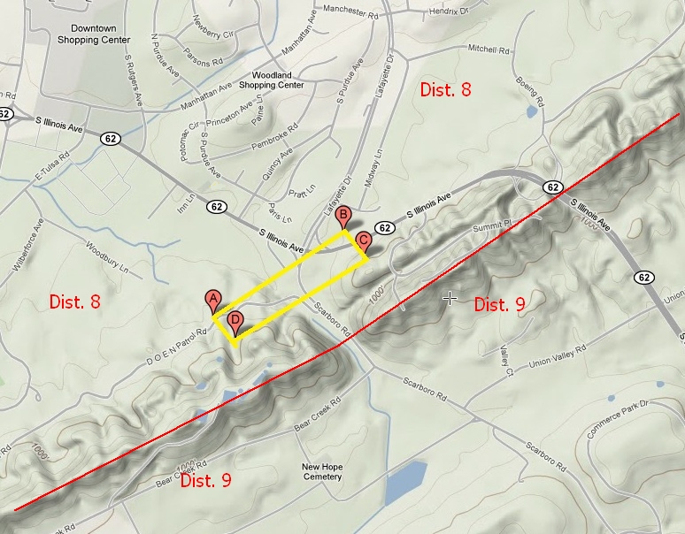
This 20 acre parcel of land was one of four parcels owned by my fourth great grandfather William Cross in Dist. 8 of Anderson County, Tennessee. The four parcels totaled 174 acres. These 174 acres have been the key to unlocking the identities of William's children.