Jerry Bryan's Web Pages

Historical Markers in Sevier County, Tennessee


The first three markers are associated with Major Hugh Henry. I am not descended from Hugh Henry, but my Bryan family lived in the Henry's Crossroads area of Sevier County which was named for the Henry family. Peter Bryan was my fifth great grandfather, and none of his descendants married into the Henry family. Peter's brother Allen S. Bryan Sr. also settled in Henry's Crossroads, and three of Allen's daughters married three of Hugh Henry's sons. I therefore have many individuals with the Henry surname in my genealogy database.


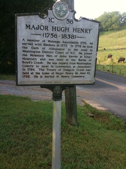
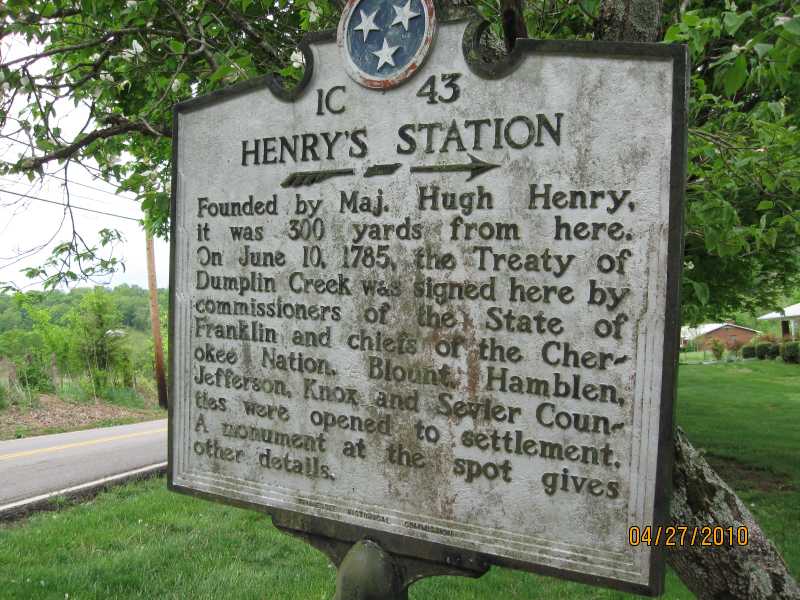
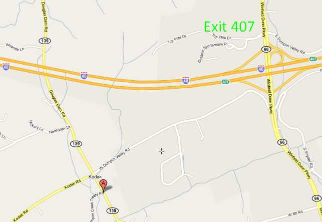
Henry's Station and Treaty of Dumplin Creek

Henry's Station Historical Marker

Henry's Station Historical Marker Map

Henry's Station Historical Marker Map The Henry's Station marker (point A) is located at the intersection of Douglas Dam Road and Dumplin Creek Treaty Road.  That intersection in turn is just a couple of hundred yards from "downtown Kodak", which is the intersection of Douglas Dam Road and Kodak Road.  The GPS coordinates are 35.97293, -83.62598.
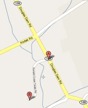
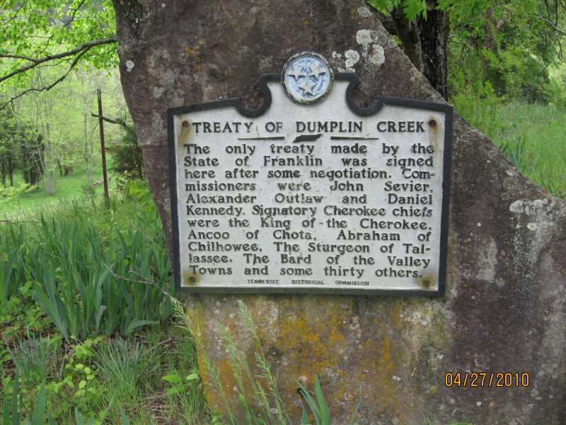
The Treaty of Dumplin Creek marker (point B) is located at the end of Dumplin Creek Treaty Road.  The GPS coordinates are 35.97017, -83.62759.


Major Hugh Henry Historical Marker

The map for the Hugh Henry Historical Marker and for the Hugh Henry Cemetery uses Google Maps, where I am unable to place a label on the two pins. The two pins are only about 100 feet apart and with the live Google Map you can change the view to see where the marker and cemetery are located relative to other locations. The historical marker is next to the road (the west side of the map) and the cemetery is up a small hill above the cemetery marker (the east side of the map). The GPS coordinates for the pins are 35.963316,-83.636431 and 35.9634142,-83.6360023, respectively.


Return to Jerry's Home Page

This page last edited on 15 Sep 2020.