Jerry Bryan's Web Pages

Appalachian Trail, Davenport Gap to Chestnut Branch Trail (1.9 miles one way)

Great Smoky Mountains National Park, trailhead Davenport Gap, NC/TN State Line, TN State Route 32 and Mt. Sterling Road on NC side.  GPS: N 35.77082 W 83.11131


Terrain map of Davenport Gap trailhead area

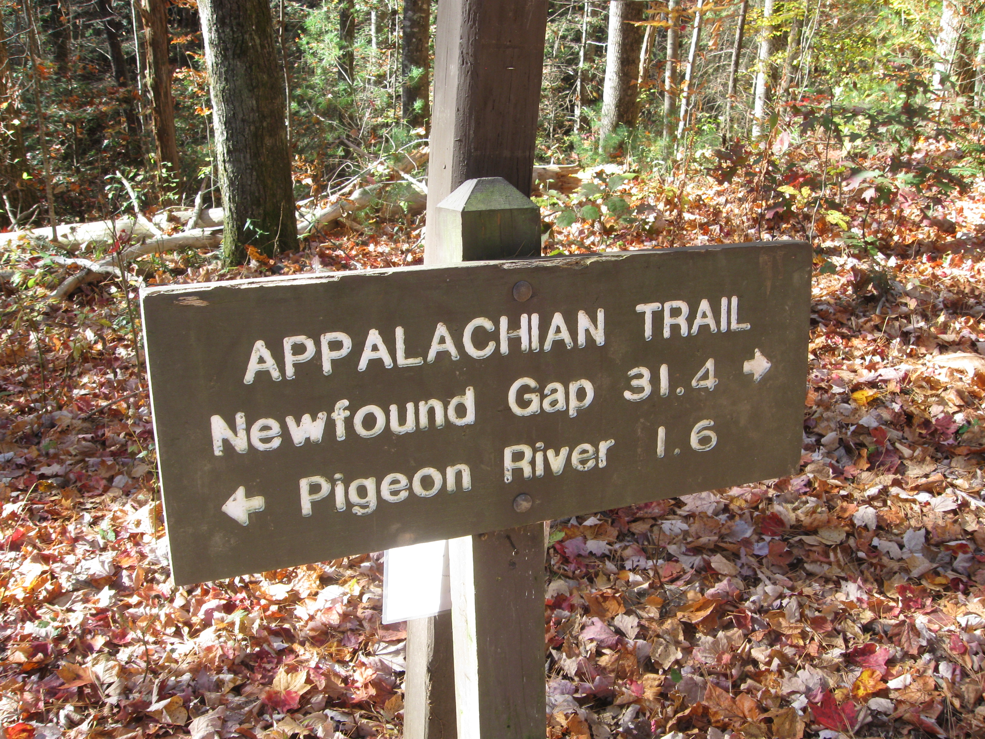
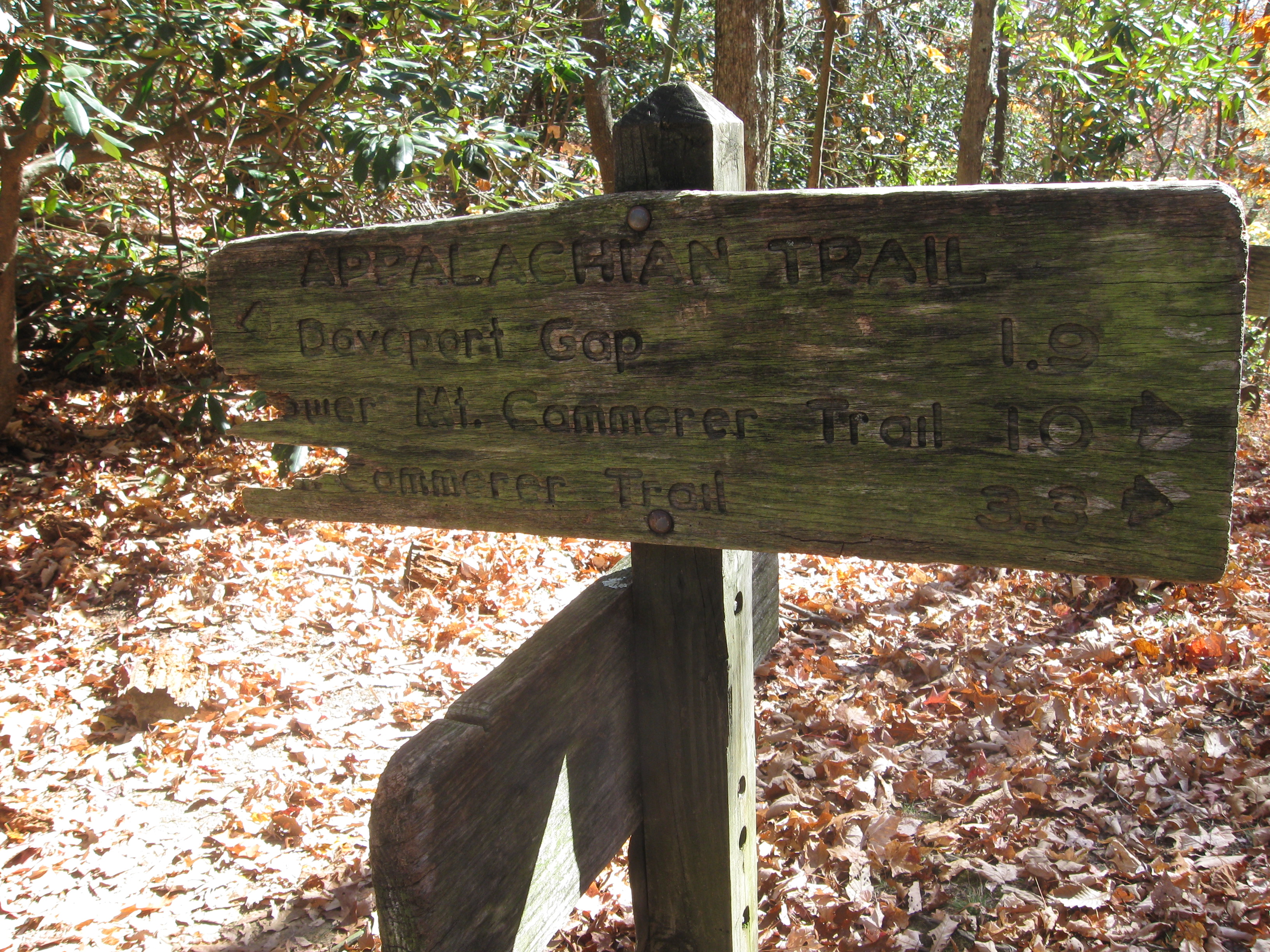
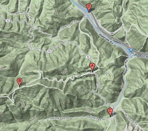
The trailhead is at Davenport Gap at point A.  The Appalachian Trail proceeds west from Davenport Gap into the park.  From the point of view of the overall Appalachian Trail, this is the southbound direction.  Mt. Sterling Road is the park boundary for this part of the park, and the parking area is therefore just outside of the park.  Immediately after getting on the trail westbound (southbound), you are in the park.

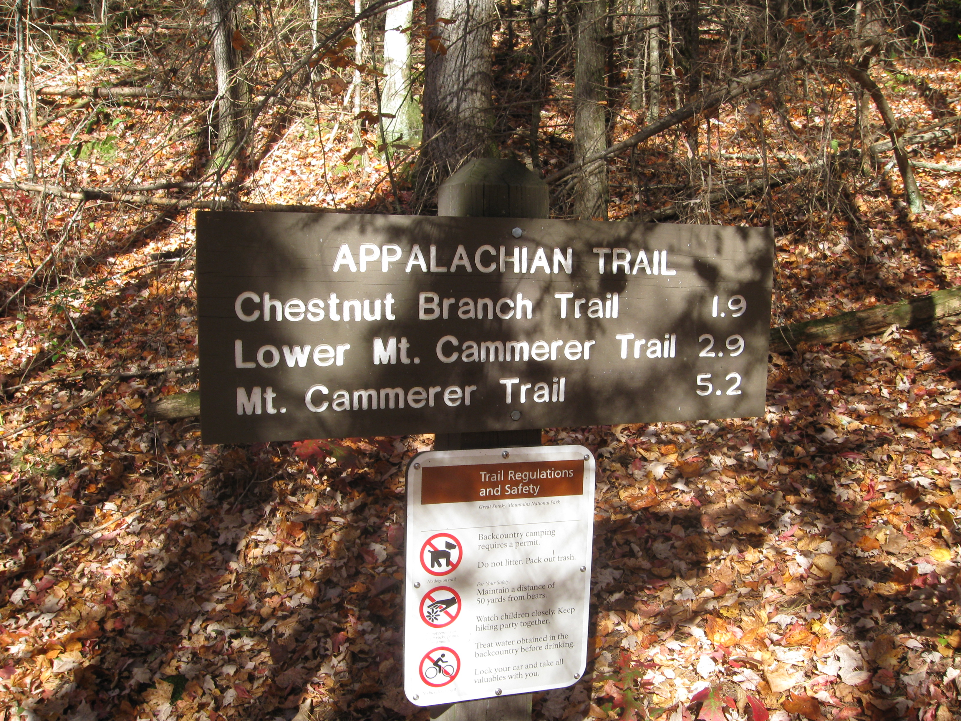
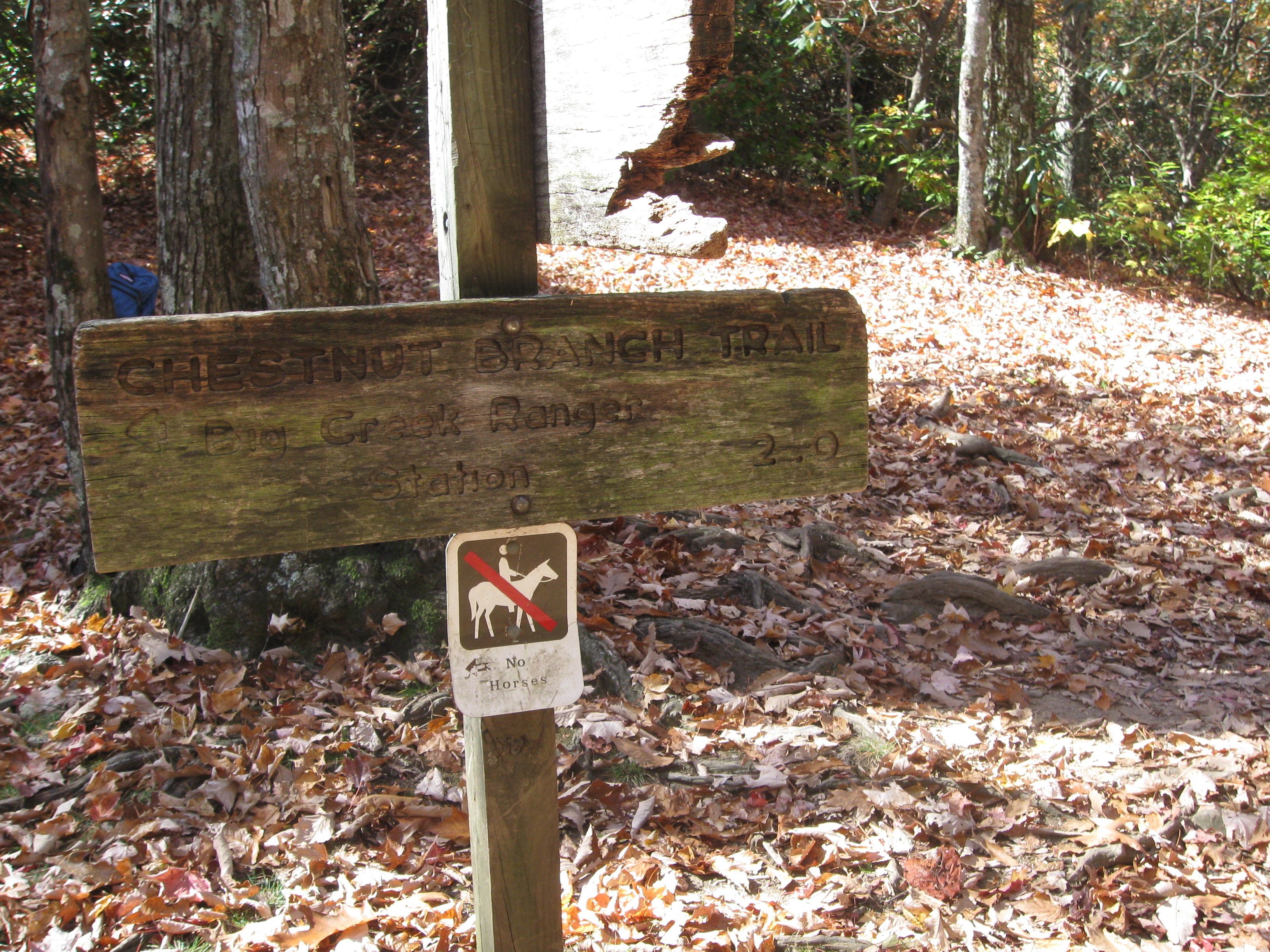
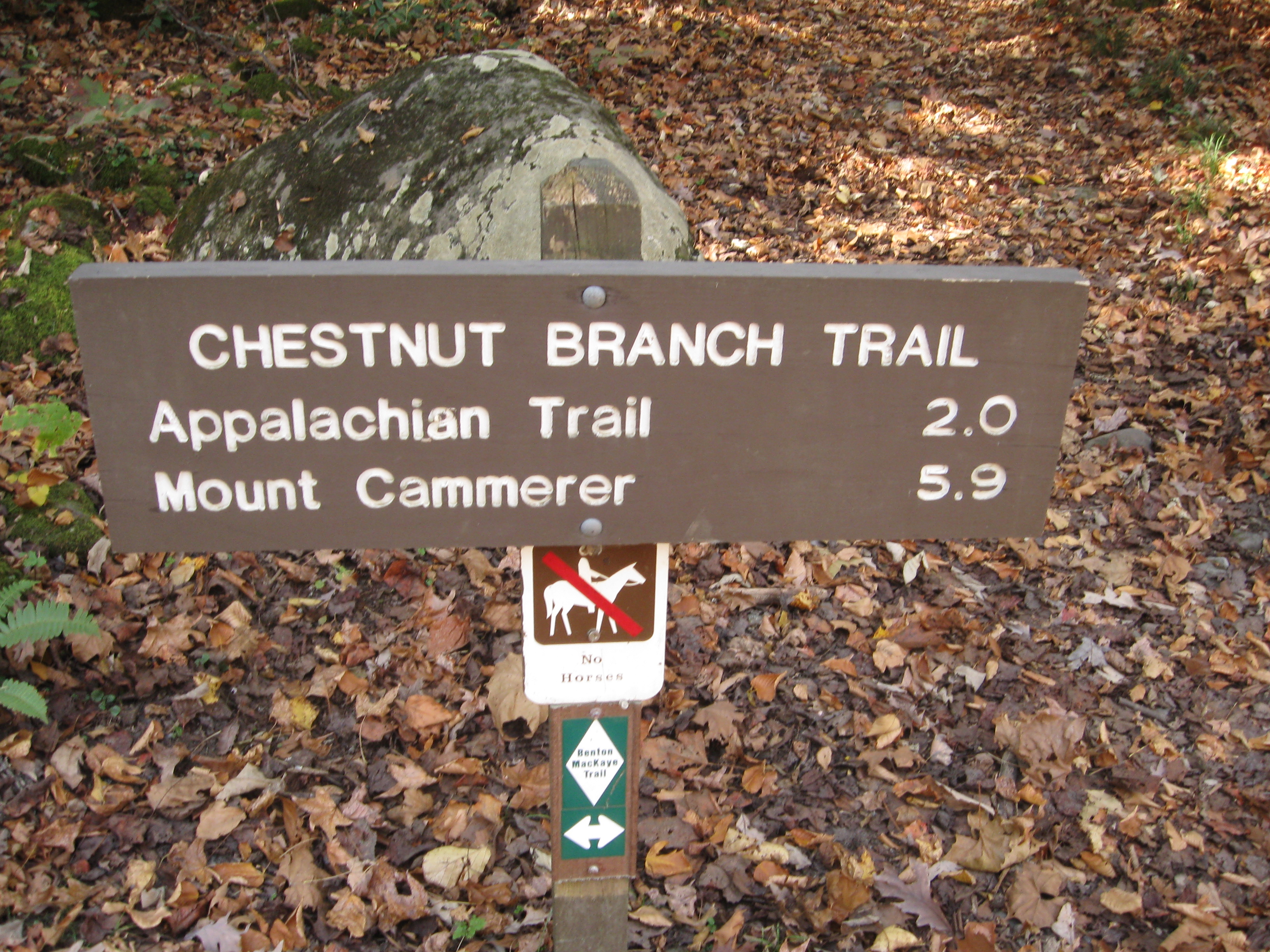
Point B is the intersection of the Appalachian Trail with the Chestnut Branch Trail, and point C is the trailhead for the Chestnut Branch Trail at the Big Creek Ranger Station.

To get to the trailhead, exit from I-40 at the Waterville Road exit at point D, cross the Pigeon River, and follow Waterville Road to Mt. Sterling Road just before the Big Creek Ranger Station.  The bridge across the Pigeon River is at the end of the exit ramp from the Interstate.  The Appalachian Trail crosses the Pigeon River at the same bridge.  At the intersection of Waterville Road with Mt. Sterling Road, turn right and follow Mt. Sterling Road to the trailhead at Davenport Gap at point A.


25 Oct 2012, 5.5 miles

I hiked 1.9 miles on the Appalachian Trail from Davenport Gap to the intersection with the Chestnut Branch Trail, 2.1 miles down the Chestnut Branch Trail to its trailhead at the Big Creek Ranger station, and 1.5 miles on Mt. Sterling Road back up to the parking area at Davenport Gap.

Davenport Gap Trailhead Closeup
My standard photograph of the trailhead sign.

Appalachian trail northbound from Davenport Gap (eastbound at this point)
The Appalachian Trail northbound towards the Pigeon River (actually eastbound at this point), outside the park and on the opposite side of the road from the Davenport Gap trailhead.

Second Davenport Gap Trailhead Closeup
A second trailhead sign, about 100 feet from the beginning of the trail.

Davenport Gap Shelter
Davenport Gap Shelter, a standard stop on the Appalachian Trail.

Appalachian Trail Intersection with Chestnut Branch Trail
Trail sign, Appalachian Trail intersection with Chestnut Branch Trail.

Appalachian Trail Intersection with Chestnut Branch Trail
Trail sign, Appalachian Trail intersection with Chestnut Branch Trail.

Appalachian Trail Intersection with Chestnut Branch Trail
Trail sign, Appalachian Trail intersection with Chestnut Branch Trail.

Chestnut Branch Trail trailhead, end of today's hike
Trail sign, trailhead of Chestnut Branch Trail, end of today's hike.


Return to Jerry's Home Page

This page last edited on 14 Nov 2012.