Jerry Bryan's Web Pages

Gabes Mountain Trail

Great Smoky Mountains National Park, trailhead at the entrance to Cosby Campground

6.6 miles from the Cosby Campground to the intersection with the Maddron Bald Trail. Shorter hikes are 2.2 miles to Henwallow Falls or 4.8 miles to backcountry shelter 34.


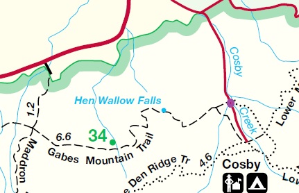
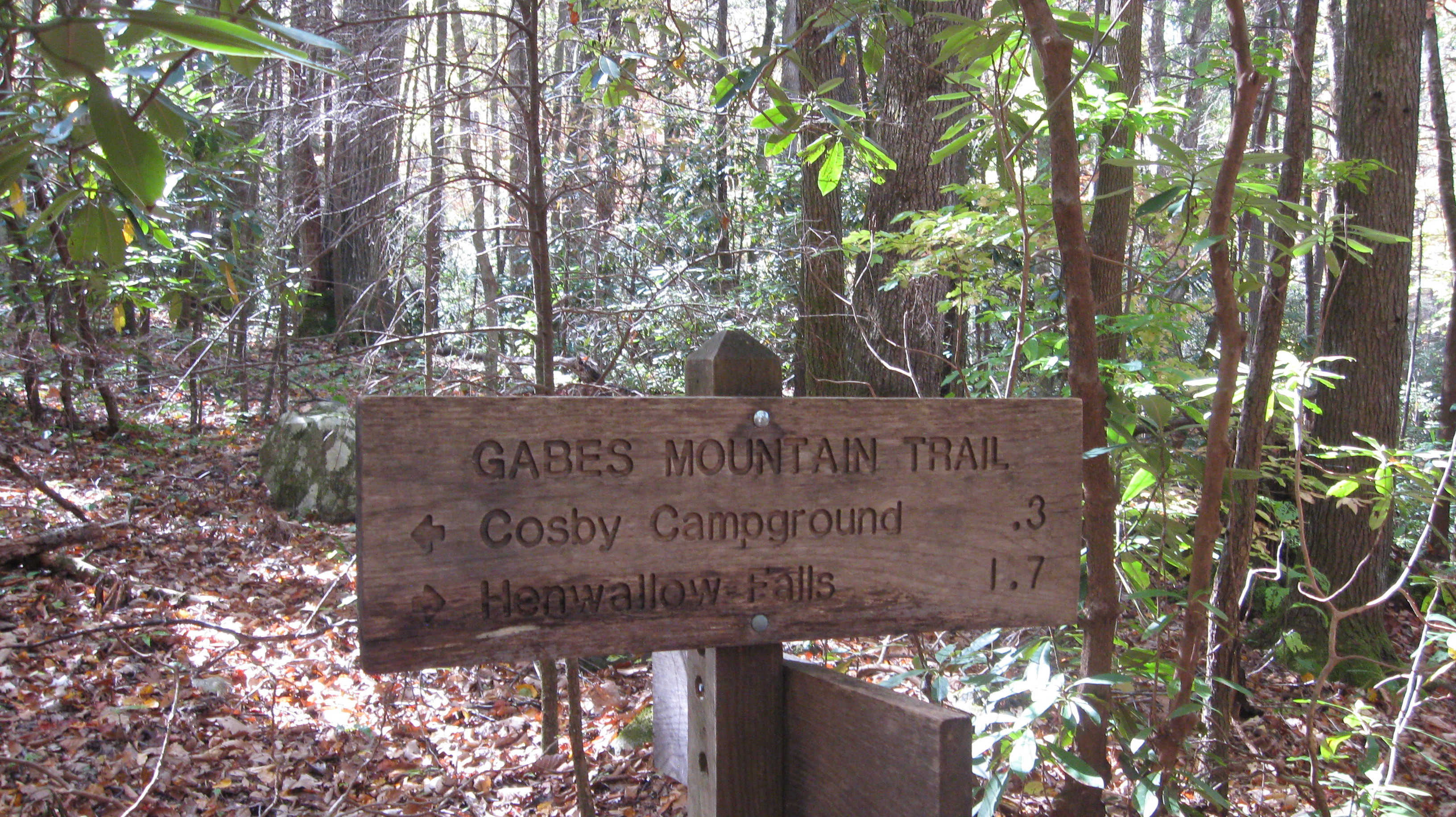
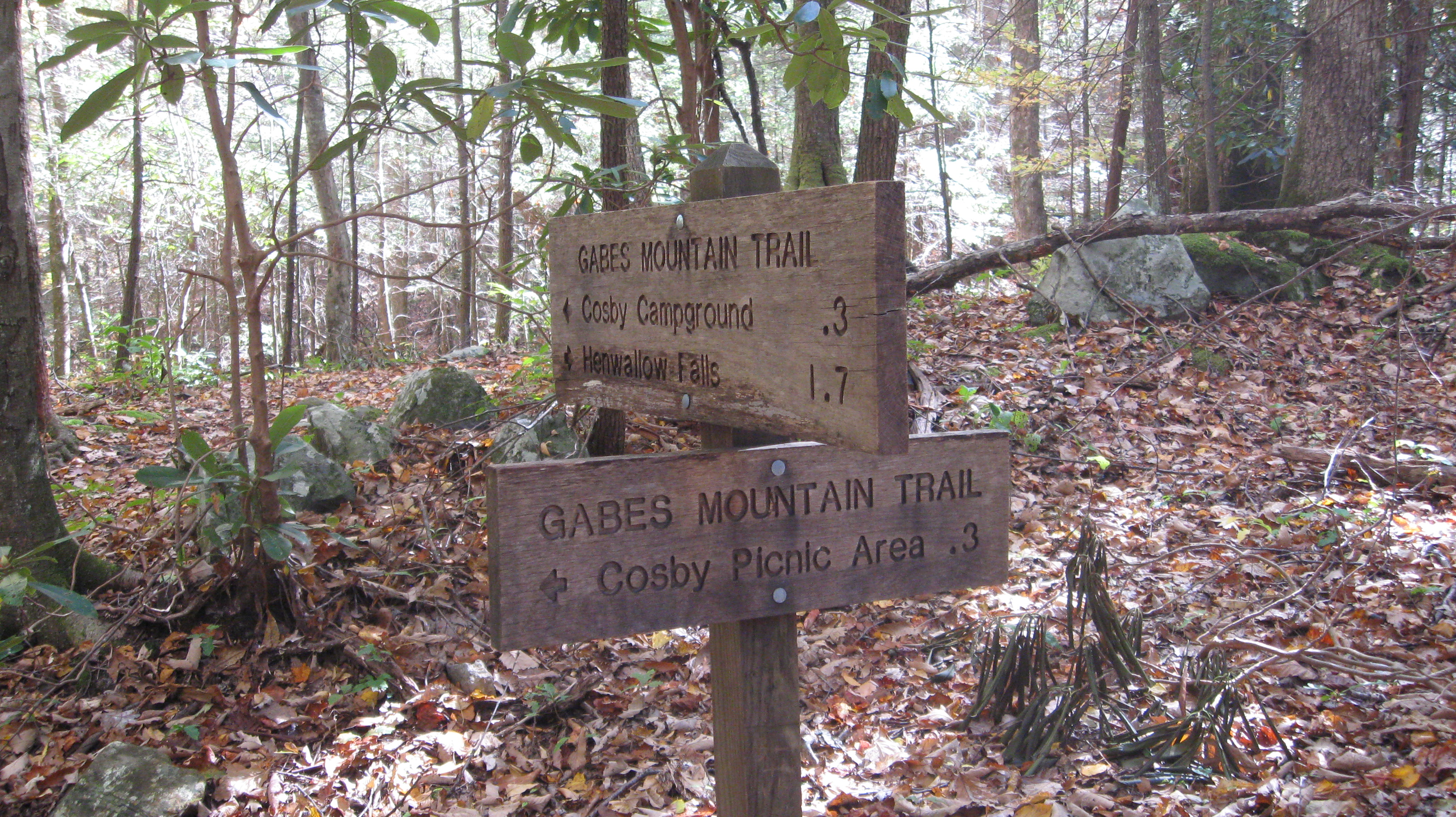
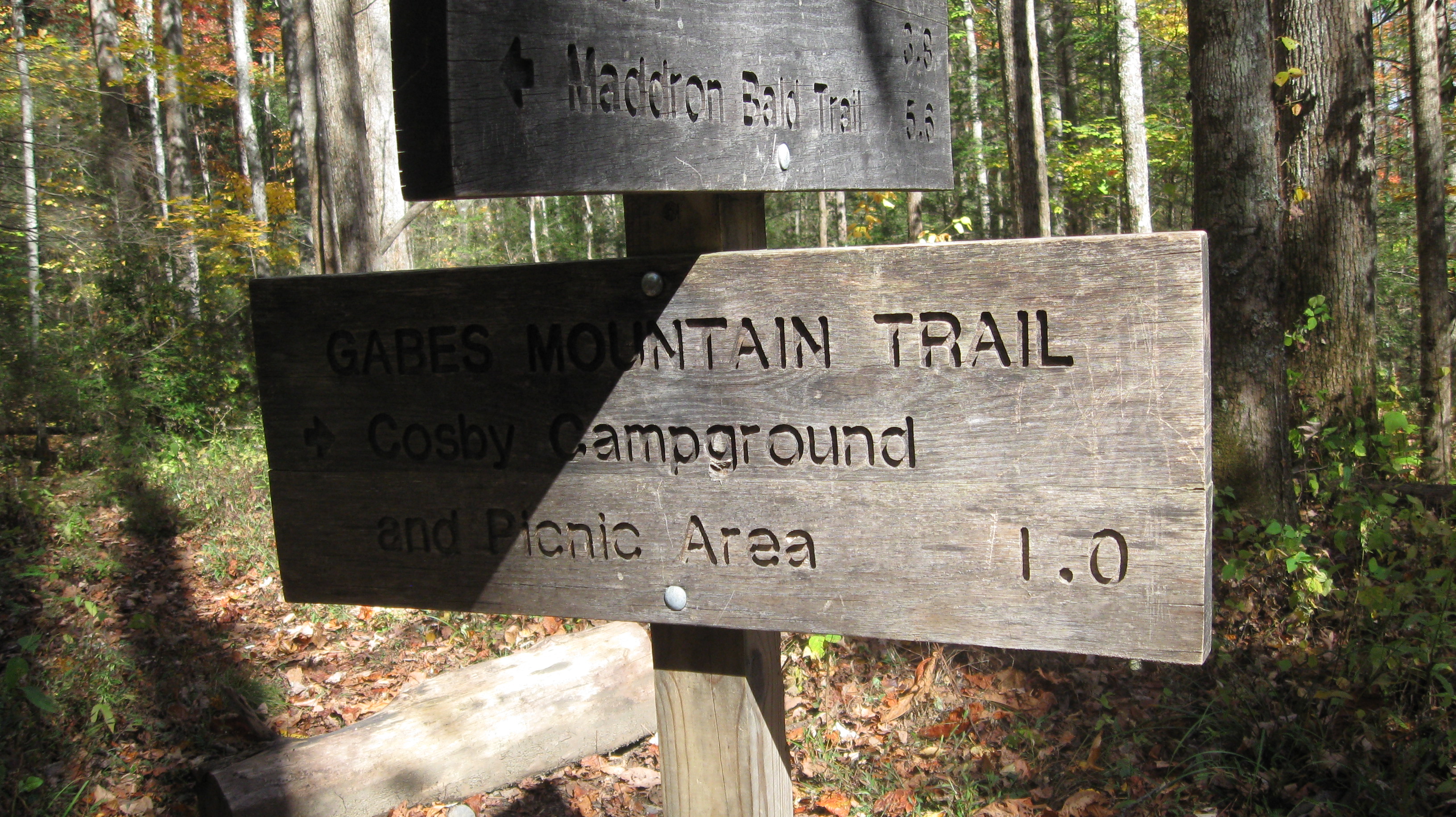
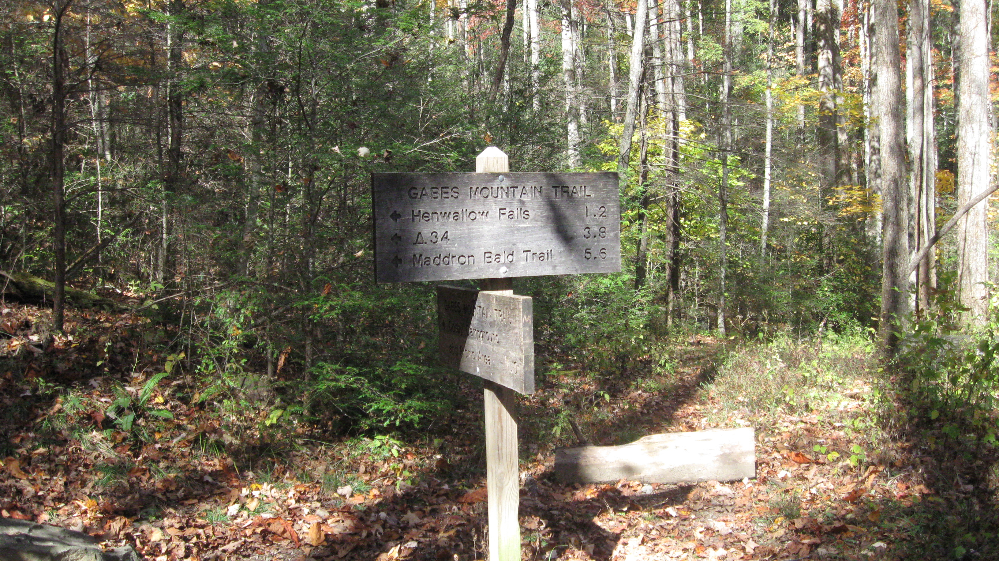
The trailhead is not far from the Cosby entrance to the park.  The trailhead is usually described as being in the Cosby Campground, but in all truth the trailhead is at the entrance to the campground rather than actually being in the campground.

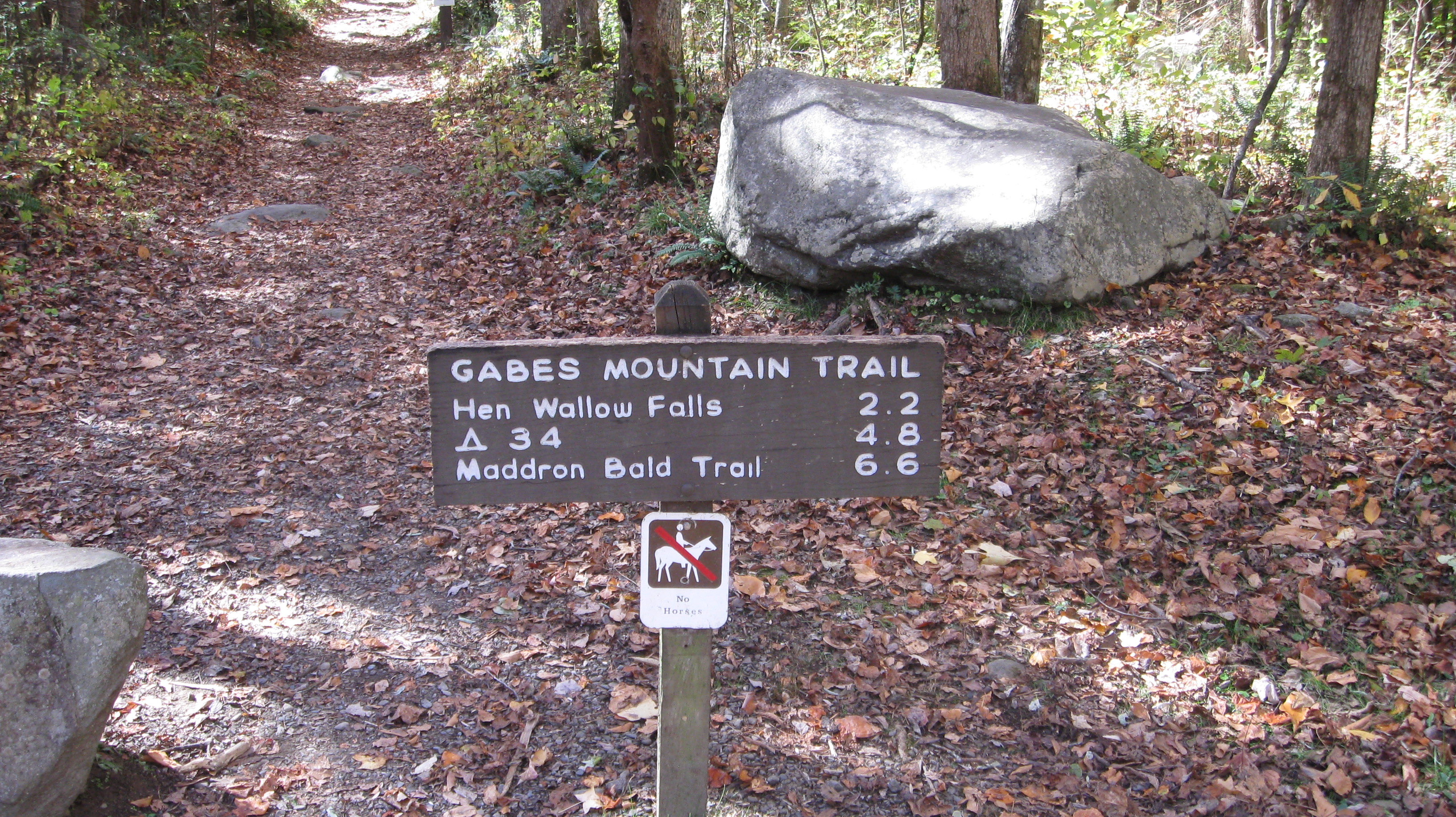
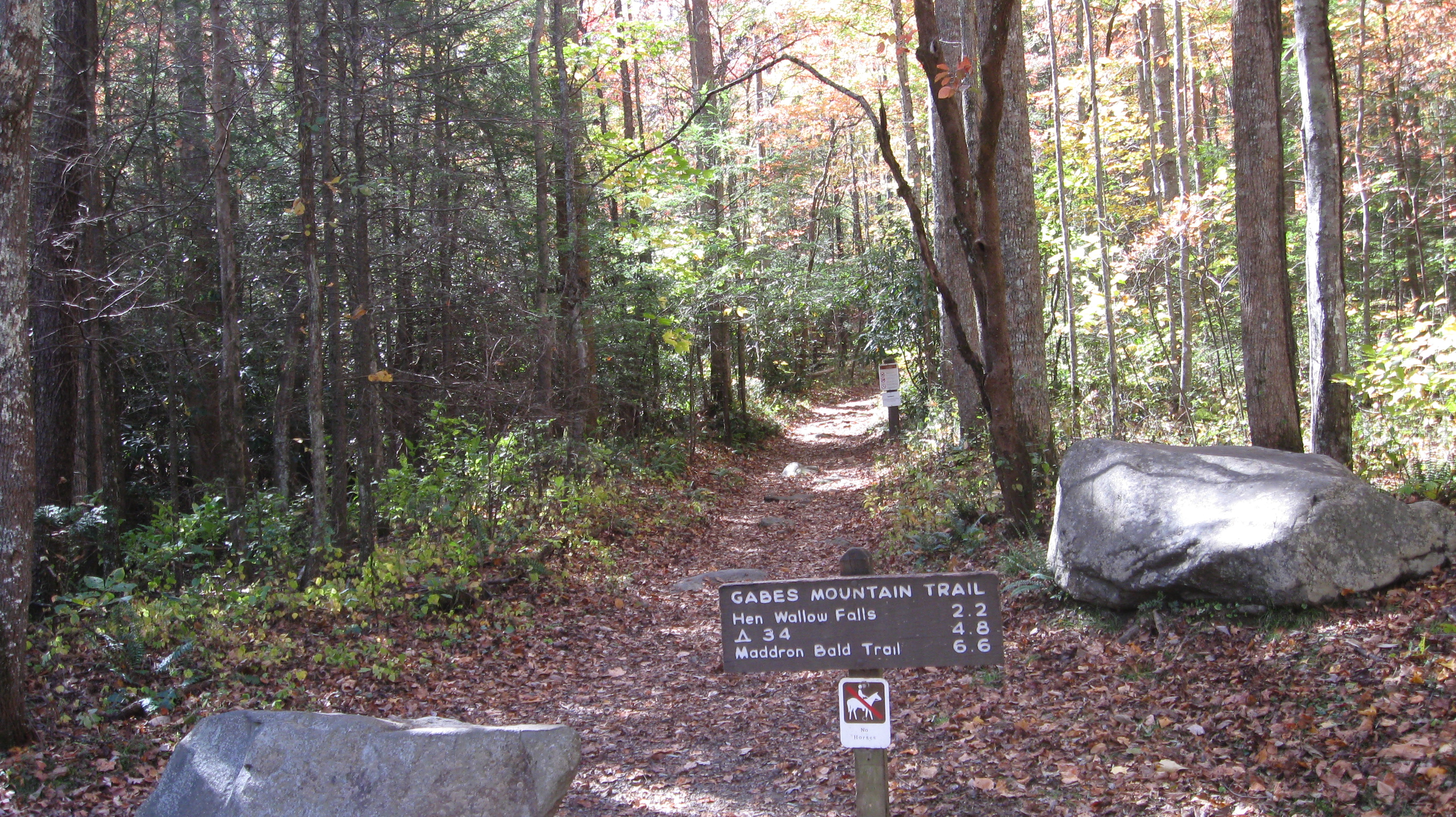
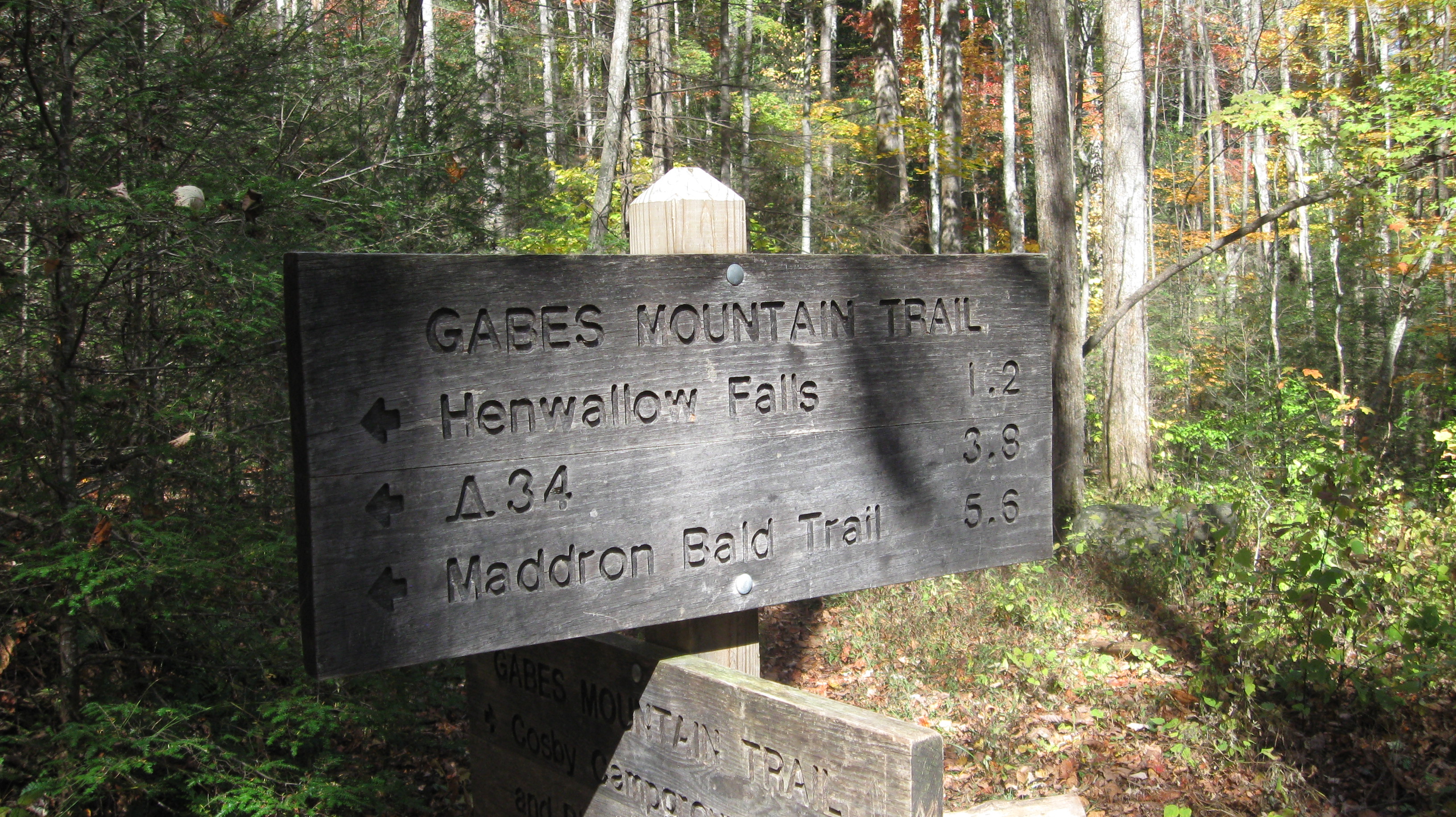
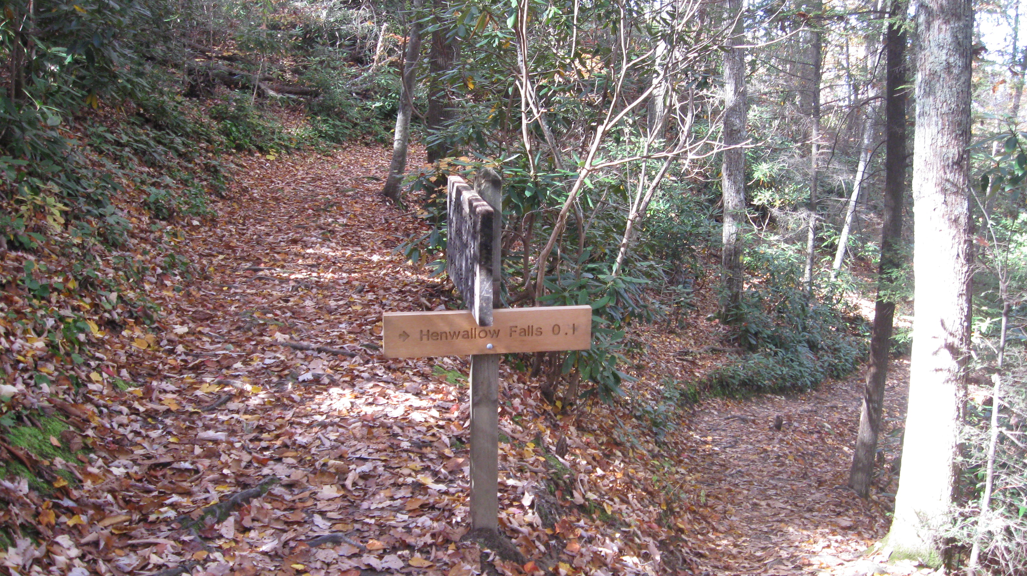
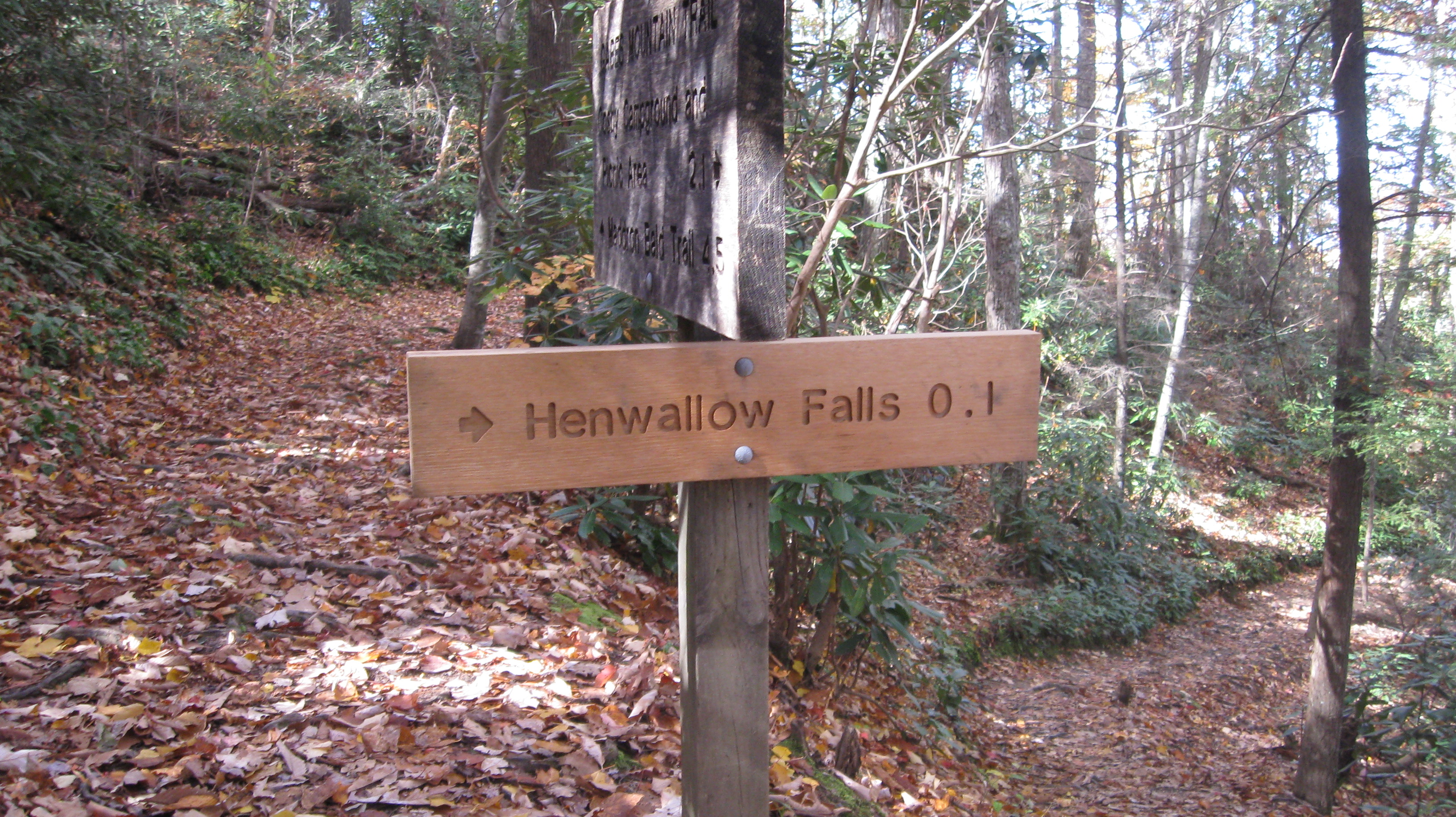
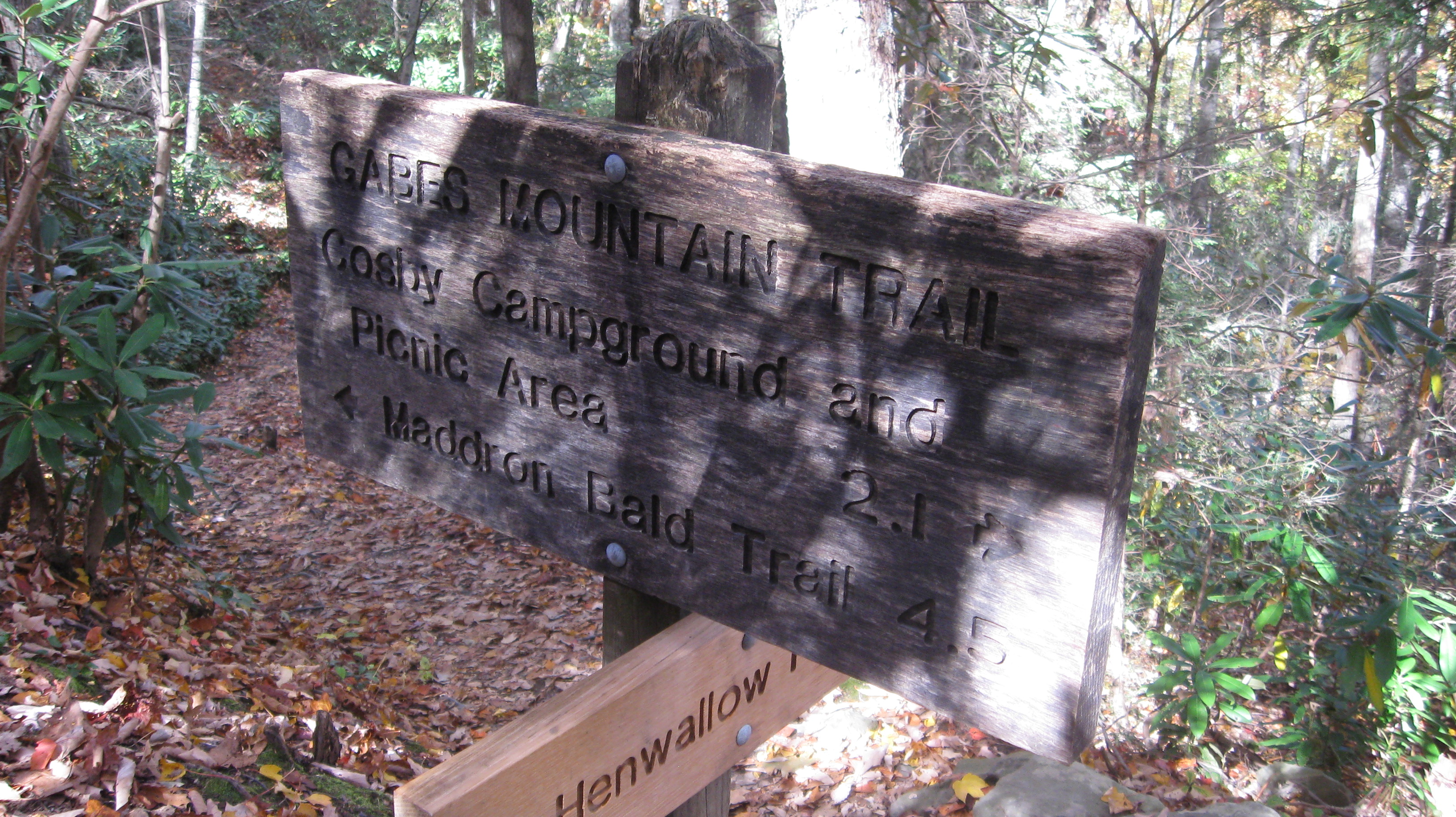
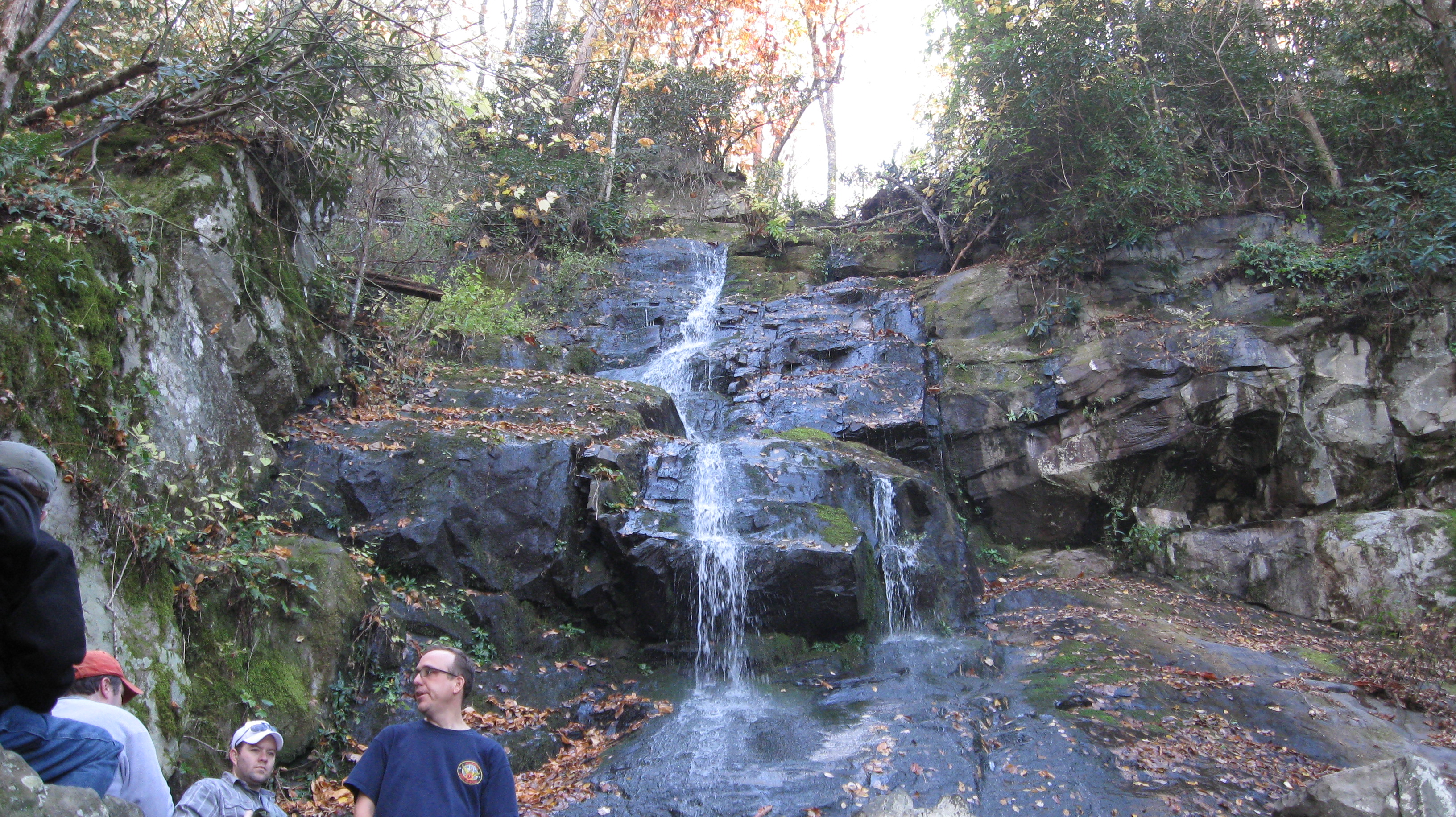
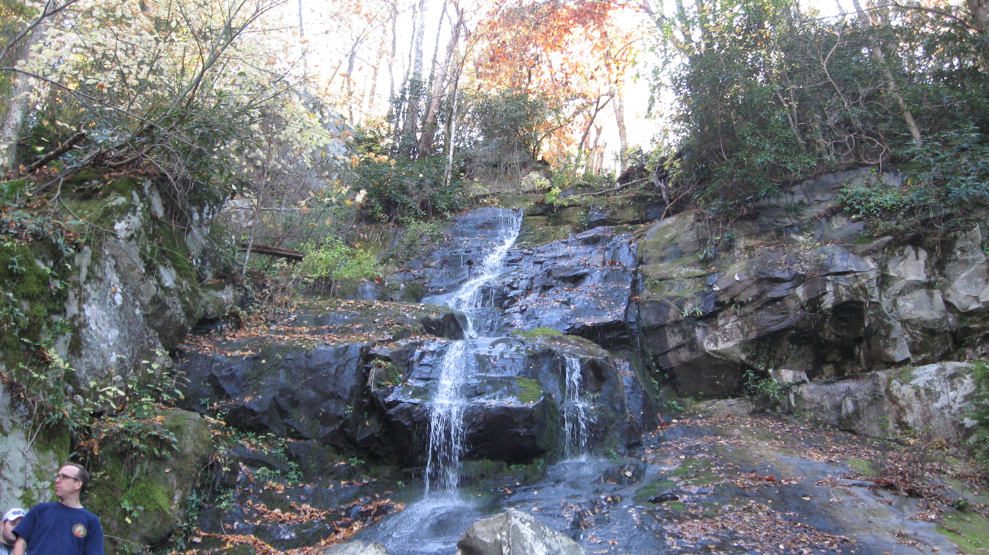
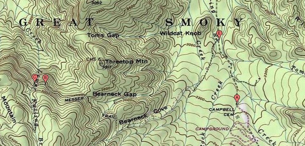
An older name for the trail is the Messer Trail.  On a topographic map, the route shown for the Messer Trail is the same as the route shown on other maps for the Gabes Mountain Trail except that the trail head for the Messer Trail was about a half mile further from the campground.  Point A is the modern trailhead, and Point E was the old trailhead.  It's possible to use either trailhead, and routes from the two trailheads join together not too far from the road.  Point B is a cut-off from the main trail to get to Henwallow Falls, and Point C is Hen Wall Falls itself.  The Gabes Mountain Trail continues for more than 4 miles west of the falls, so that only about the eastern third of the trail is shown on the map at this scale.

Topographic map of Gabes Mountain trail

There are two basic ways to get to the Cosby entrance to the park.

  • 18 miles from Gatlinburg to Cosby via Route 321 to Route 32.  Turn right towards the park when you reach Route 32.  If you know the area well, you there are several good back road ways to get to Route 321 between Cosby and Gatlinburg without having to fight with Gatlinburg traffic.
  • From Newport to Cosby via one of three different exits from I-40.  Using exit 435, it's about 15 miles from Newport to Cosby via Route 32.  Continue on Route 32 all the way into the park  Using exit 440, it's about 16.5 miles from Newport to Cosby via Route 321 to Route 32.  Turn left towards the park when you reach Route 32.  This route is slightly faster and less scenic than going from exit 435.  Using exit 443, it's about 16.9 miles from Newport to Cosby using Foothills Parkway.  Turn left towards the park when you reach Route 32.  This route is slightly slower and is definitely much more scenic than the other two routes.

The trail is much more clear on the this trail map than on the topographic map above, but the trail map has no topographic information.  Also, the two maps are scaled very differently.  In particular, this trail map shows the entire trail, not just the eastern third of the trail.

The trailhead is the purple dot, Henwallow Falls is the blue dot, the green dot labeled 34 is backcountry shelter 34, and end of the trail is at the intersection with the Maddron Bald Trail.

Hiking map of Gabes Mountain Trail

22 Oct 2011, 4.4 miles

I hiked to Henwallow Falls and back.  It was 2.2 miles up and 2.2 miles back.

Gabes Mountain Trailhead sign
Gabes Mountain trailhead sign.

Gabes Mountain Trailhead sign
Gabes Mountain trailhead sign.


The trail head of the Gabes Mountain Trail, Cosby Campground, Cosby entrance to the park.

Trail sign near the trailhead where the trails from the two different trailheads join up
Trail sign near the trailhead, where the trails from the two different trailheads join up.


Trail sign near the trailhead where the trails from the two different trailheads join up
Trail sign near the trail head, where the trails from the two different trailheads join up.

Log bridge across a little creek
Log bridge across a little creek.


Trail sign at a bend in the trail
Trail sign at a bend in the trail.  There is no trail intersection, just the bend.

Trail sign at a bend in the trail
Trail sign at a bend in the trail.  There is no trail intersection, just the bend.


Trail sign at a bend in the trail.  There is no intersection, just a bend in the trail.

Trail sign at a bend in the trail
Trail sign at a bend in the trail.  There is no trail intersection, just the bend.


Interesting rock cliff long the trail
Interesting rock cliff along the trail.

Interesting rock cliff long the trail
Interesting rock cliff along the trail.


Interesting rock cliff along the trail.

Little side trail to Henwallow Falls
Little side trail to Henwallow Falls.  On this particular hike, I went down to the falls and then returned to the trailhead rather than continuing on the main trail.


Close up of the Henwallow Falls trail sign

Close up of the Henwallow Falls trail sign


Video of fork from main trail to Henwallow Falls.

Henwallow Falls
Henwallow Falls.


Henwallow Falls
Henwallow Falls.

Video of Henwallow Falls.


Return to Jerry's Home Page

This page last edited on 18 Nov 2014.