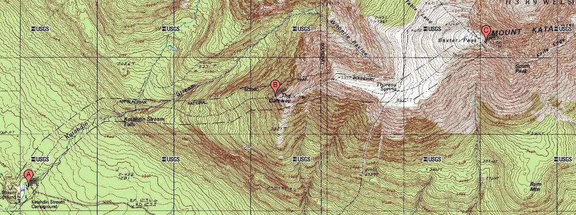
The Hunt Trail begins at point A at the Katahdin Stream Campground and proceeds to the top of Mount Katahdin at point C. In addition to being the end of the Hunt Trail, point C is also northern terminus of the entire Appalachian Trail.
|
|
The Hunt Trail begins at point A at the Katahdin Stream Campground and proceeds to the top of Mount Katahdin at point C. In addition to being the end of the Hunt Trail, point C is also northern terminus of the entire Appalachian Trail. |
|
My son hiked the Appalachian Trail north to south beginning on 15 Jul 2007. The northern terminus of the trail is Baxter Peak at the top of Mount Katahdin in Baxter State Park in Maine. You really can't start at the Appalachian Trail at Baxter Peak. Rather, you have to start at the Katahdin Stream Campground which is on the Appalachian Trail about 5.2 miles south of Baxter Peak. You start by hiking from the campground to the top of the mountain and then backtracking down to the campground. The next day, you start your journey on the Appalachian Trail from the campground, southbound to Georgia. I took my son to the Katahdin Stream Campground, and my plan was to hike Mount Katahdin myself before driving home. But the hike exceeded my physical conditioning and preparation. I would like to try it again after I retire, but I will have to work very hard first to be sure I'm well prepared. |
|
|
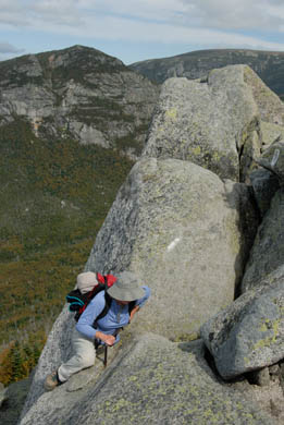
I made it to a large boulder field that begins at about point B on the trail map. I'm not 100% sure of the location where the boulder field begins. The next time I try to climb the mountain, I'll be sure to have a GPS receiver with me that I can use to note various way points on the trail. I didn't make the picture to the left. Rather, I found it on the Internet. It is an image of the exact place where I was unable to proceed any further. |
This page last edited on 29 Jan 2012.