Jerry Bryan's Web Pages

Laurel Falls Trail

Great Smoky Mountains National Park, trailhead Little River Road, 3.8 miles from Sugerlands Visitors Center.

It is 1.3 miles to Laurel Falls, and an additional 2.7 miles to the end of the trail.


Topographic map of Laurel Falls trail

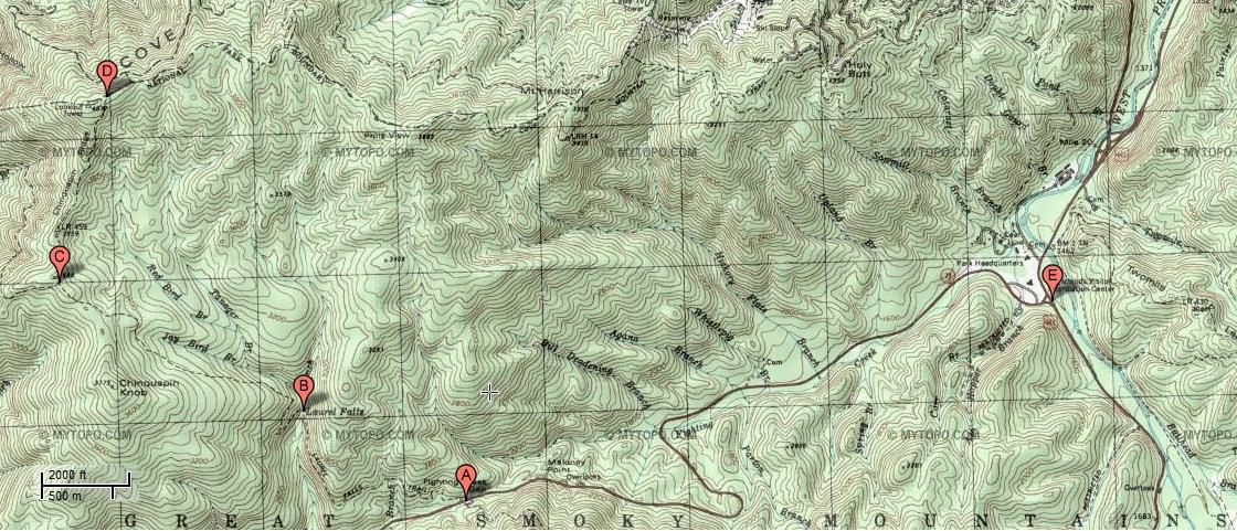
The trailhead is on Little River Road, about 3.8 miles from the Sugerlands Visitors Center (point E).  Nominally, the best way to get to the trailhead is to go through Sevierville and Pigeon Forge, and then to take the Gatlinburg bypass to Sugerlands just south of Gatlinburg.  However, the tourist traffic on that route is so congested that it's often better to go to the Townsend Y and take Little River Road from that direction.

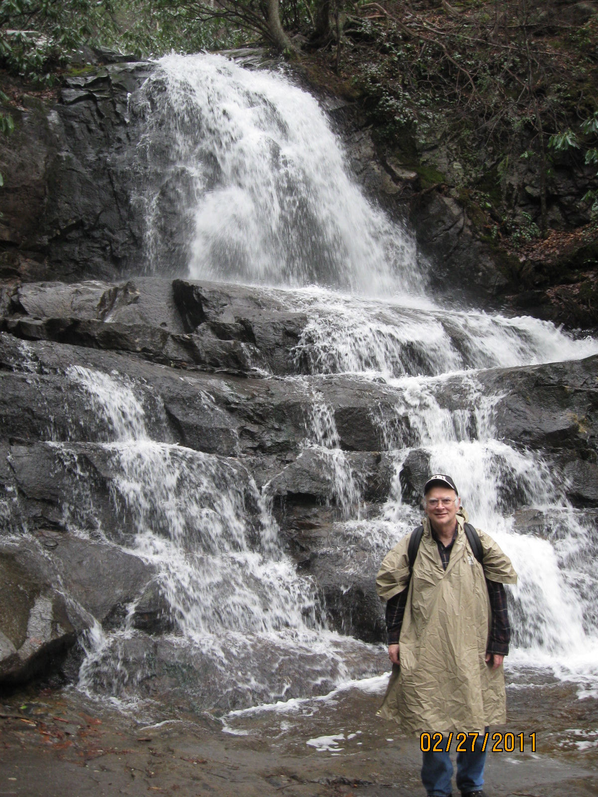
From the trailhead (point A), the trail is paved for the first 1.3 miles to Laurel Falls (point B).  That section of the trail is the most used section of trail anywhere in the park, and there are usually families with small children and strollers.

At 3.1 miles from the trailhead, the trail forms a junction with the Little Greenbrier Trail (point C).  The trail continues ahead until its terminus at 4.0 miles from the trailhead where it forms a junction with the Cove Mountain Trail (Point D).


Hiking map of Laurel Falls trail

The trail is much more clear on the trail map than on the topographic map, but the trail map has no topographic information.  Also, the two maps are scaled very differently.

On the trail map, paved roads are in red.  As is the case on the on the topo map, Point A is the trailhead, point B is Laurel Falls, point C is the intersection with the Little Greenbrier Trail, point D is the trail terminus at the intersection with the Cove Mountain Trail, and point E is the Sugerlands Visitors Center.


27 Feb 2011, 3.6 miles

I hiked 1.3 to Laurel Falls and another 0.5 miles past the falls, for a total one way trip of 1.8 miles and a total round trip of 3.6 miles.  It was reasonably warm for February, and the weather forecast that morning was for sunshine.  However, I encountered heavy rain showers on the trail, and the weather report on way home said 70% chance of heavy rain showers.  So the forecast had obviously changed after I left the house in the morning.

me in front of Laurel Falls
Me in front of Laurel Falls (with my rain slicker!).

Laurel Falls, Great Smoky Mountains National Park, 27 Feb 2011 from Jerry Bryan.

Laurel Falls has three main cascades, and the trail crosses the creek between the second and third cascade.  It was too wet and muddy to climb down to the bottom of the third cascade, so this video only shows the two upper cascades.

View to the South from Laurel Falls trail
Little River Road runs roughly east and west, and the Laurel Falls Trail runs roughly north from Little River Road towards the park boundary.  However, the beginning of the trail actually swings to the west for a while before curving back to the north.  There are several good views from this westbound swing back to the high ridges to the south, and this is one such good view.

I haven't yet identified the little round peak in the center of the photo.  I suspect it is Blanket Mountain, but I will have to hike the trail again and get an accurate heading of the sight line from the trail to the peak to be sure.  The picture was taken at GPS 35.674422, -83.592568.


Return to Jerry's Home Page

This page last edited on 11 Jun 2011.