Jerry Bryan's Web Pages

Middle Prong Trail

Great Smoky Mountains National Park, trailhead at the end of Tremont Road

4.1 miles from Tremont Road to the intersection with the Greenbrier Ridge and Lynn Camp Prong Trails


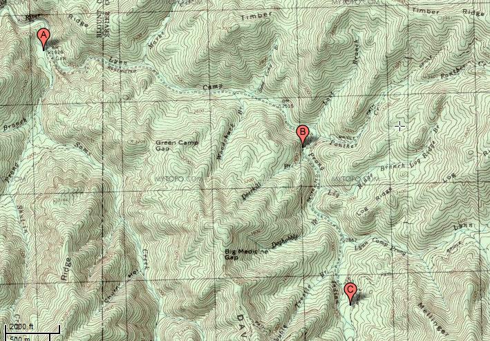
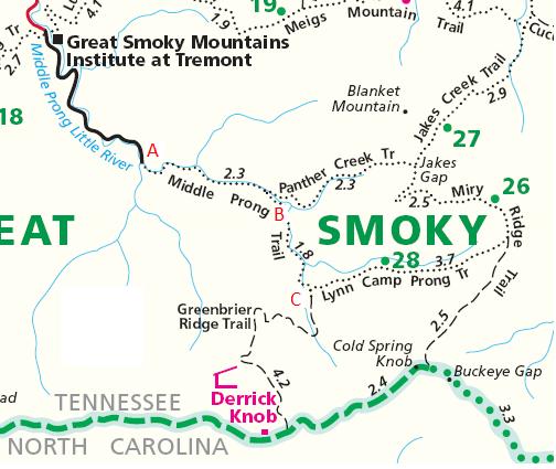
The trailhead is at the end of Tremont Road.  To get to Tremont, turn right at the Townsend Y onto Laurel Creek Road towards Cades Cove, and turn left towards Tremont a couple of hundred yards later.  Go 2.3 miles to Tremont, and go past Tremont itself and go all the way to the end of the road.  The end of the road is about 3.1 miles past Tremont.

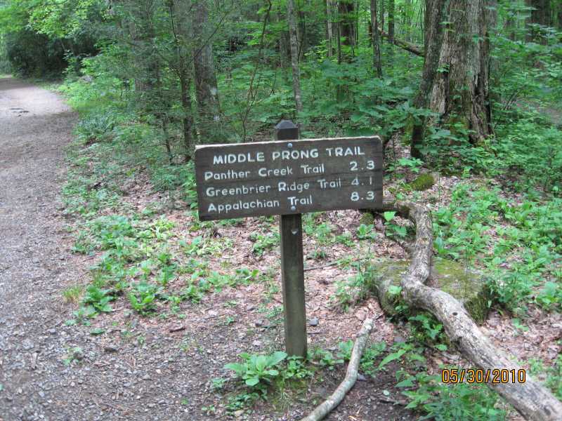
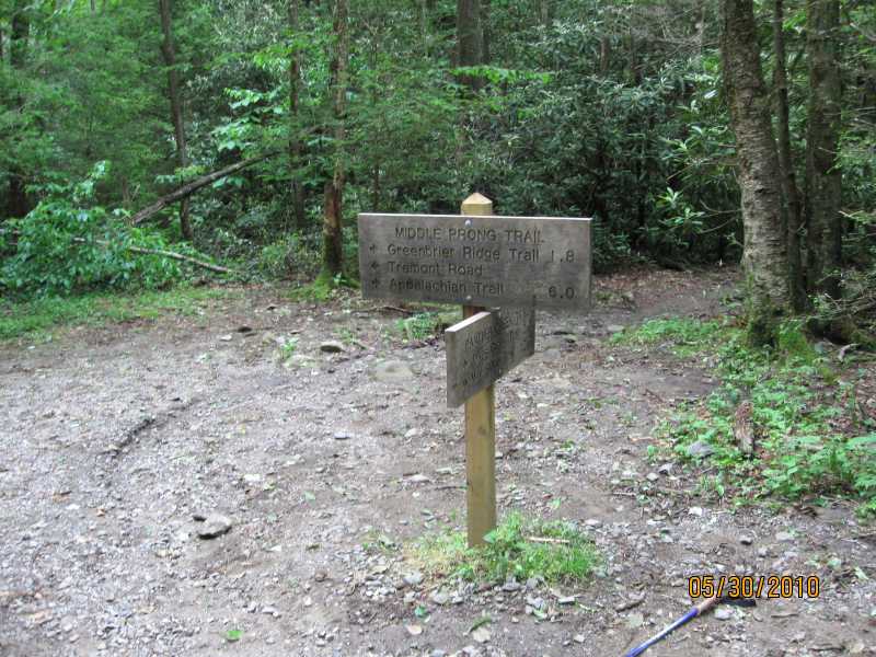
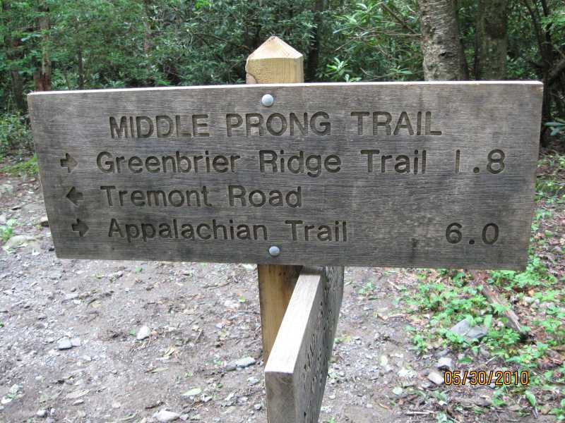
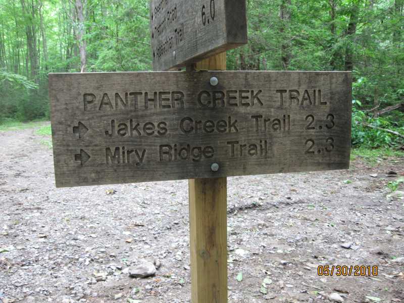
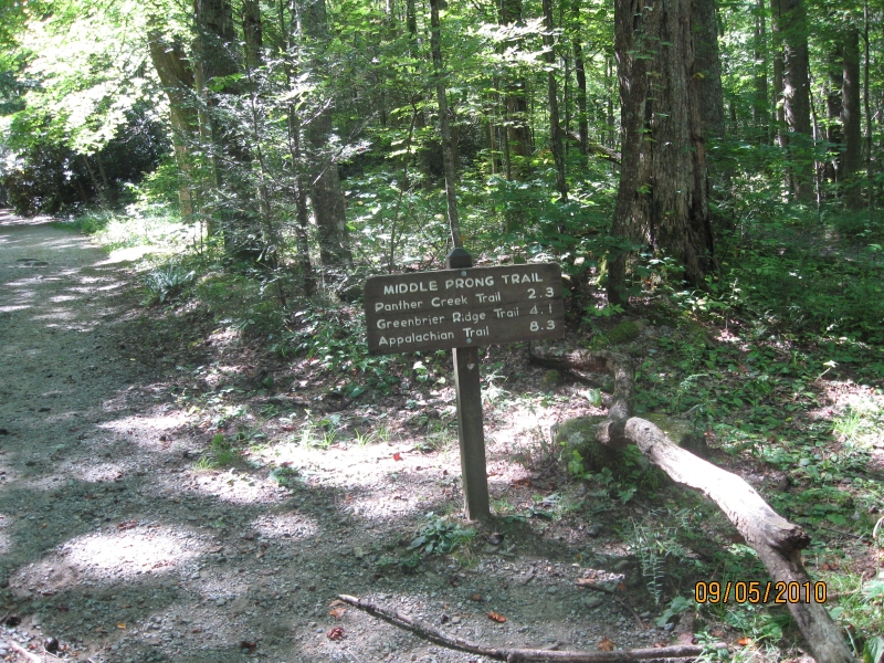
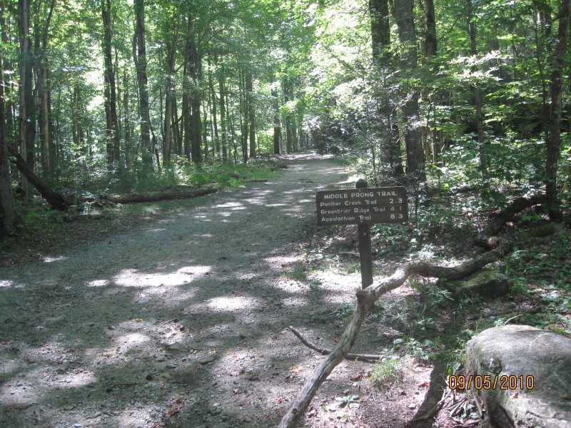
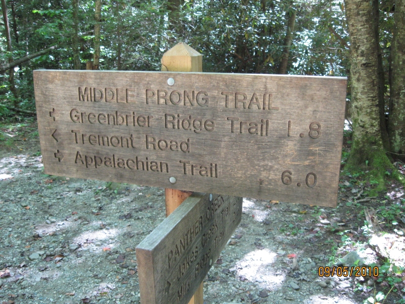
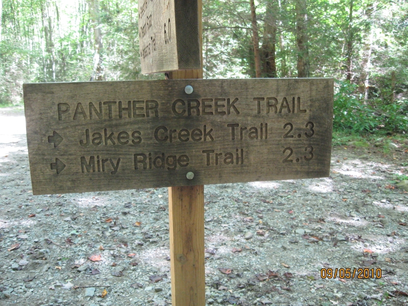
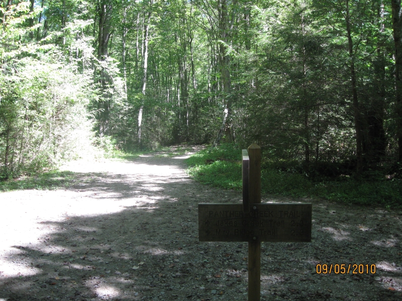
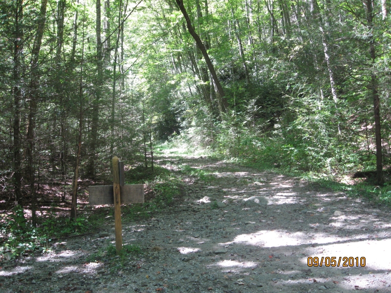
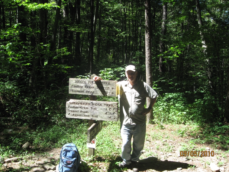
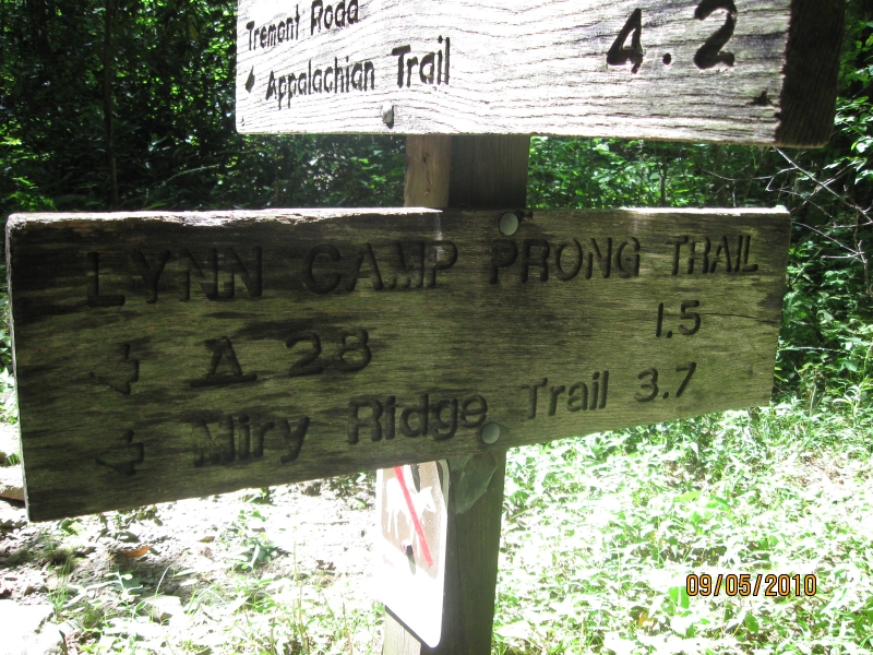
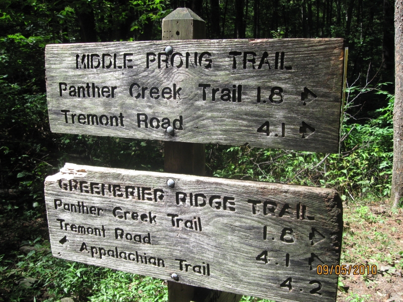
At the trailhead (point A), the Lynn Camp Prong and the Thunderhead Prong join to form the Middle Prong of the Little River.  The trail follows the Lynn Camp Prong upstream.  The first 2.3 miles of the trail follow an old railroad bed that was used for logging.  At 2.3 miles, there is an intersection with Panther Creek trail (point B).  At that point, the old railroad bed ends, and the trail becomes narrower, rockier, and steeper.  The trail terminates at the intersection with the Greenbrier Ridge and the Lynn Camp Prong trails (point C).

Topographic map of Middle Prong trail

The trail is much more clear on the trail map than on the topographic map, but the trail map has no topographic information.  Also, the two maps are scaled very differently.

On the trail map, paved roads are in red.  As is the case on the on the topo map, Point A is the trailhead, point B is the intersection with the Panther Creek trail, and point C is the end of the trail which is the intersection with the Greenbrier Ridge and the Lynn Camp Prong trails.

Hiking map of Middle Prong trail

13 Jun 2009, 4.6 miles

I hiked to the Panther Creek trail intersection and back.  It was 2.3 miles up and 2.3 miles back.


30 May 2010, 4.6 miles

It was a cool late spring day, and the weather was alternately gray and bright several times.  Thunder storms were predicted, but it never rained.  I hiked to the Panther Creek trail intersection and back.  It was 2.3 miles up and 2.3 miles back.

Middle Prong Trailhead sign
Middle Prong trailhead sign.

A little cascade on the Middle Prong Trail.  The trail actually follows Lynn Camp Prong,so the little cascade is on Lynn Camp Prong.


Middle Prong sign - intersection with Panther Creek trail
Middle Prong trail intersection with Panther Creek trail, 2.3 miles from the trailhead.

Middle Prong sign - intersection with Panther Creek trail
A close up of the aforementioned sign at the intersection of the Middle Prong trail and the Panther Creek trail.


Middle Prong sign - intersection with Panther Creek trail
Another close up of the aforementioned sign at the intersection of the Middle Prong trail and the Panther Creek trail.


5 Sep 2010, 8.2 miles

I hiked to the Greenbrier Ridge trail intersection and back.  The Greenbrier Ridge intersection is the end of the Middle Prong trail.  It was 4.1 miles up and 4.1 miles back.

Middle Prong Trailhead sign
Middle Prong trailhead sign.

Middle Prong Trailhead sign
Middle Prong trailhead sign.


Middle Prong sign - intersection with Panther Creek trail
Middle Prong trail intersection with Panther Creek trail, 2.3 miles from the trailhead.  On previous hikes of the Middle Prong trail, this was my turnaround point.  But today, I continued another 1.8 miles to the intersection with the Greenbrier Ridge trail.

This view of the trail sign reflects the fact that continuing straight ahead it is 1.8 miles to the Greenbrier Ridge Trail and that continuing straight ahead it is 6.0 miles to the Appalachian trail.  This view of the sign also reflects that by turning around and going back down the trail you will return to the trailhead on Tremont Road.  But the sign does not show that it's 2.3 miles back down to the trailhead.

Middle Prong sign - intersection with Panther Creek trail
Middle Prong trail intersection with Panther Creek trail, 2.3 miles from the trailhead.  On previous hikes of the Middle Prong trail, this was my turnaround point.  But today, I continued another 1.8 miles to the intersection with the Greenbrier Ridge trail.

This view of the trail sign reflects the fact that turning left places you on the Panther Creek trail whence it is 2.3 miles to the three way intersection with the Jakes Creek trail and the Miry Ridge trail.


Middle Prong sign - intersection with Panther Creek trail
Still at the intersection of the Middle Prong trail and the Panther Creek trail, looking back down the Middle Prong Trail towards the trailhead.  The Panther Creek trail is to the right.

Middle Prong sign - intersection with Panther Creek trail
Still at the intersection of the Middle Prong trail and the Panther Creek trail, looking up the the Middle Prong Trail towards the intersection with the Greenbrier Ridge Trail.  The Panther Creek trail is to the left.


Middle Prong sign - intersection with Greenbrier Ridge trail
Self portrait at the end of the Middle Prong trail.  The trail ends at its intersection with the Greenbrier Ridge trail and the Lynn Camp Prong trail.

Middle Prong sign - intersection with Greenbrier Ridge trail
Close up of the sign at the end of the Middle Prong trail pointing to the Lynn Camp Prong trail.  The Lynn Camp Prong trail is 3.7 miles long, and terminates at its intersection with the Miry Ridge Trail.  Also, back country campsite #28 is 1.5 miles up the Lynn Camp Prong trail.


Middle Prong sign - intersection with Greenbrier Ridge trail
Another close up of the sign at the end of the Middle Prong trail.  The upper part of the sign points back down the trail, back down 1.8 miles to the intersection with the Panther Creek trail and 4.1 miles to the trailhead at Tremont Road.

The lower part of the sign repeats the same information that is on the upper part of the sign (very strange!), plus it points up the Greenbrier Ridge trail 4.2 miles to the end of the Greenbrier Ridge trail at its intersection with the Appalachian Trail.

Middle Prong sign - intersection with Greenbrier Ridge trail
Close up of the sign at the end of the Middle Prong trail showing a bear warning.  I saw a cub up a tree on the way up the trail, but I never saw the mother and the cub was gone when I went back down the trail.


A video of the trail intersection at the end of the Middle Prong trail.  It's a three way intersection with the Middle Prong trail, the Lynn Camp Prong trail, and the Greenbrier Ridge trail.


A video of an unnamed waterfall near the end of the Middle Prong Trail.  There are multiple cascades, and this is the upper cascade.

A video of unnamed waterfall near the end of the Middle Prong Trail.  There are multiple cascades, and this view looks down from the upper cascade towards the lower cascades.  The rocks are so steep and the vegetation is so thick that I never figured out how to get down below the lower cascades.


Return to Jerry's Home Page

This page last edited on 17 Nov 2014.