Jerry Bryan's Web Pages

Spruce Flats Falls Trail

Spruce Flats Falls Trail

About 1.0 miles from Great Smoky Mountains Institute at Tremont to Spruce Flats Falls

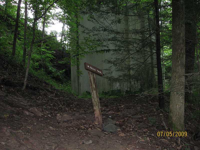
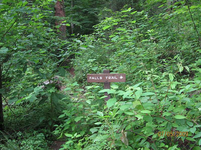
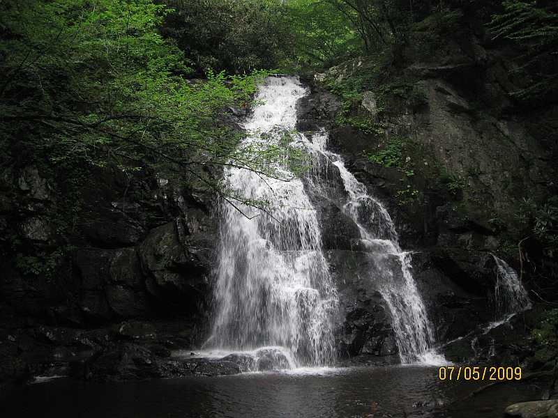
The Spruce Flats Falls trail starts at the Great Smoky Mountains Institute at Tremont.  The Institute is labeled Camp Townsend on the topo map.  The trail is not maintained by the Park Service and does not appear on any trail map that I've been able to find.

Map of Marked Spruce Flats Falls Trail

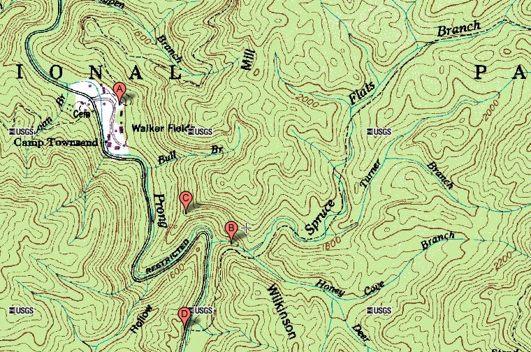
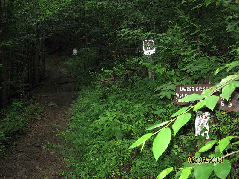
I began at Point A above some of the Tremont Institute buildings.  Point A is the trailhead for the Lumber Ridge trail.  It's arguable whether Point A is really the trailhead for the Spruce Flats Falls trail because there are several places above the Tremont Institute buildings where you can join up with the Spruce Flats Falls trail.

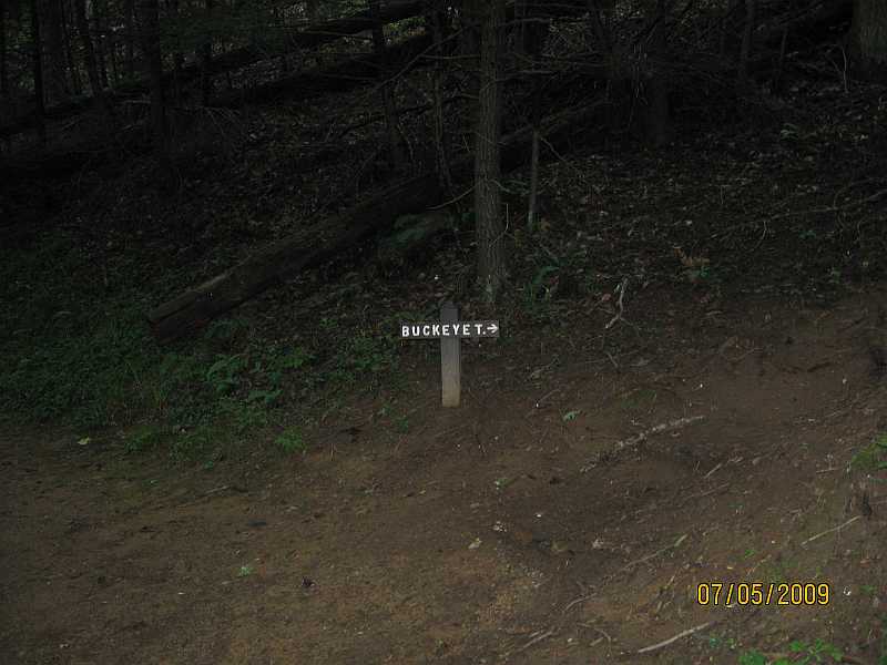
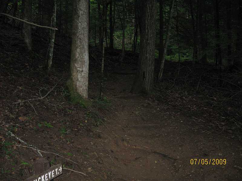
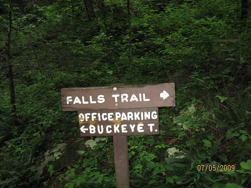
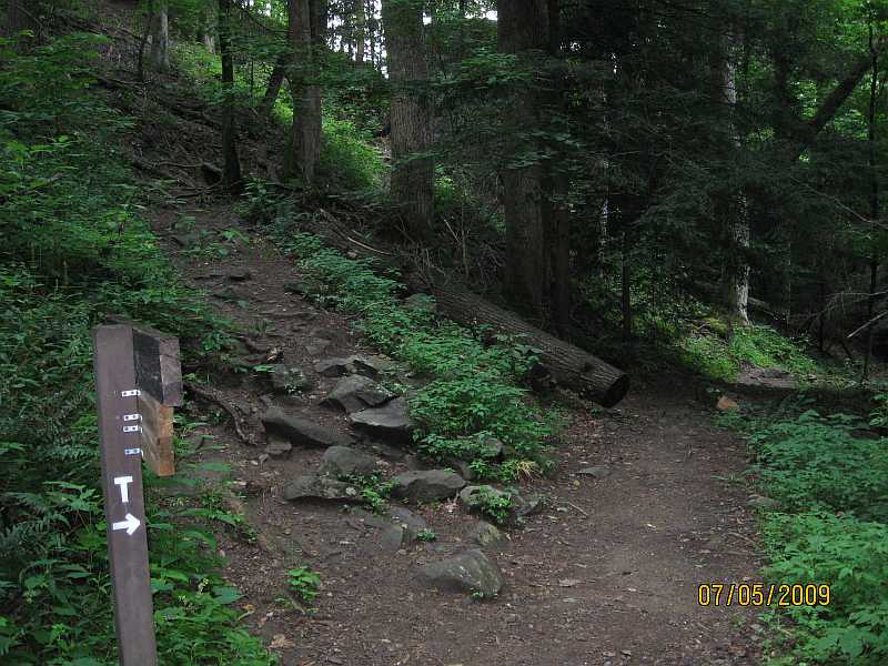
I began at Point A for a curious reason.  When I first hiked the Lumber Ridge trail, I ran into quite a few people who were looking for the waterfall.  But there is no waterfall on the Lumber Ridge trail.  It turns out that you are supposed to start on the Lumber Ridge trail and within the first 100 feet you turn off to the right on a little connector called the Buckeye Trail.  The Buckeye trail is just a little connector loop above the Tremont Institute buildings, and it doesn't go to the waterfall, either.  But within a few hundred feet it does connect to the trail that goes to the waterfall.

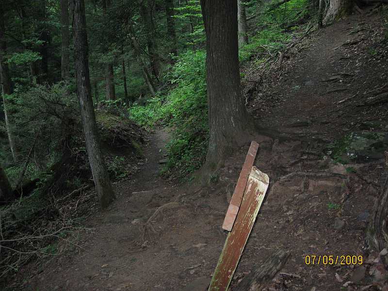
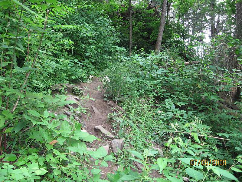
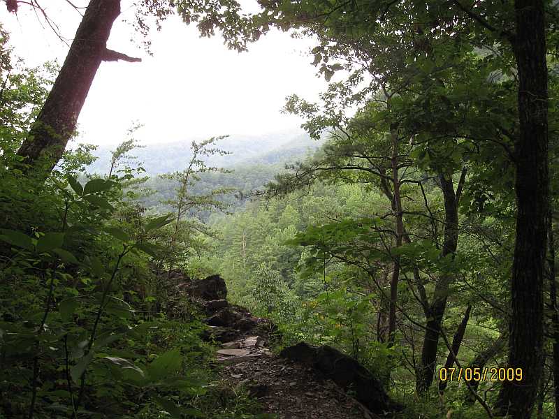
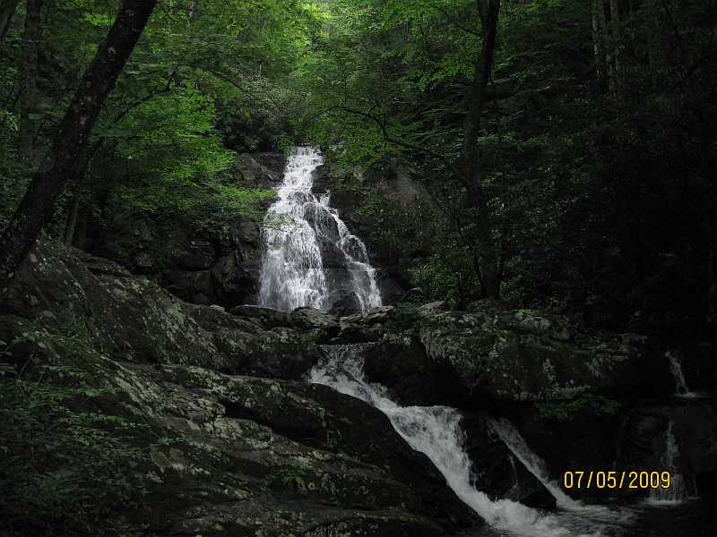
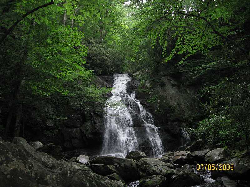
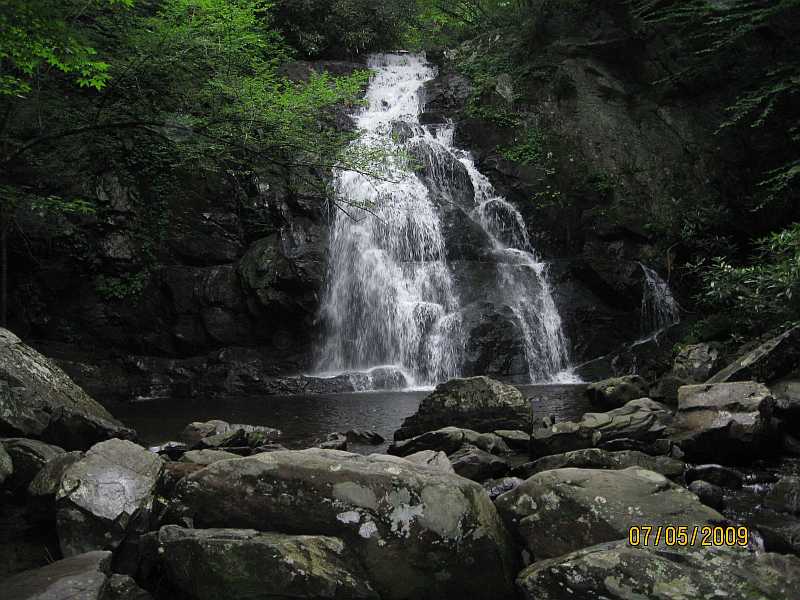
The trail makes a couple of switchbacks above Point A and climbs up the side of Mill Ridge, "turns the corner" at point C and then going down to the Spruce Flats Falls at Point B.  The trail is variously described as moderate or as steep.

An alternate route is to begin at Point D and hike up to Point B.  This is also an unmaintained trail and the trail is also called the Spruce Flats Falls trail.  The fact that two different trails have the same name makes it confusing to research the trail.  Even though it is not maintained, the Point D to Point B route does appear on topo maps.  No matter which of the two routes you use to get the waterfall, the unmaintained Spruce Flats Falls trail continues about another three miles to the east to Buckhorn Gap.  Buckhorn Gap is also the terminus of the Lumber Ridge trail, so you can get to Buckhorn Gap either way.  At the scale of this particular map, Buckhorn Gap is just off the map to the east.

The unmarked trailhead at Point D is a little tricky to find.  The way I found it the first time was to hike to the waterfall again from the Tremont Institute, and then to follow the old unmaintained trail from Point B down to Point D.  It is necessary to wade across the Middle Prong to get from the road to the trailhead or vice versa.  It can be an easy or difficult crossing depending on how high the Middle Prong is running.


Lumber Ridge trailhead, also one of the jump off points to get to the Spruce Flats Falls trail.  You can see a little sign for the Buckeye Trail back in the shadows, about as far up the trail as you can see in this picture.

Lumber Ridge trailhead

Sign for the Buckeye Trail, which is just a little local loop within the area of Tremont Institute.  The Buckeye Trail connects to the Spruce Flats Falls trail.

Buckeye trail sign

Looking up the beginnings of the Buckeye Trail.

Buckeye trail

Sign at intersection of Buckeye Trail with the Spruce Flats Falls trail.

Buckeye trail

To the right, the Buckeye trail loops back down to some of the Tremont Institute buildings.  To the left, the Spruce Flats Falls trail starts its climb up Mill Ridge.

Buckeye trail

The first switchback.  The water tower provides water for the Tremont Institute.

Buckeye trail

Looking up the trail at the first switchback with the water tower at my back.

Buckeye trail

The sign at the second switchback.  The unmaintained trail that continues forward at the switchback does not go to the falls.  I don't know where it goes, but it likely connects up to the Lumber Ridge trail.

Buckeye trail

Looking up the trail at the second switchback.  The trail is fairly overgrown at this point, and its lack of maintenance is fairly apparent.

Buckeye trail

The trail basically climbs up Mill Ridge from Tremont and goes back down the other side of Mill Ridge to get to the waterfall.  The ridge becomes a spur that ends at the Middle Prong of the Little River.  The trail goes to the end of the spur and makes a sharp left turn at that point.  The picture is at sharp left turn.  The ridge falls off sharply to the right of the picture, dropping down to the Middle Prong.  To the left of the picture, the ridge climbs very steeply.

The waterfall is on Spruce Flats Branch, and Spruce Flats Branch is a feeder stream for the Middle Prong.

Buckeye trail

The trail has only a few good views, and this is one of them.  After turning the corner to the other side of Mill Ridge, there is an excellent view of Thunderhead Mountain.  The series of ridges that includes Thunderhead lies on the state line between Tennessee and North Carolina, and the Appalachian Trail runs along the state line at that point.

Buckeye trail

This is the highest point on the trail.  From here, the trail descends to the waterfall in less than a mile.

Buckeye trail

The main falls in the background, and the lower cascade in the foreground.

Buckeye trail

The main falls.

Buckeye trail

The main falls from a little closer so you can see the pool below the falls.

Buckeye trail

On this particular occasion, there were other people at the falls so I was able to get somebody to take my picture for me.

Buckeye trail

A good closeup of the falls.  I took the picture from the same rock where I was standing when my own picture was taken.

Buckeye trail

Return to Jerry's Home Page

This page last edited on 20 Mar 2011.