Jerry Bryan's Web Pages

Unmarked Spruce Flats Falls Trail

Unmarked Spruce Flats Falls Trail

About 4.0 miles from Tremont Road to a four way intersection with Lumber Ridge Trail, Meigs Mountain Trail, and Meigs Creek Trail at Buckhorn Gap

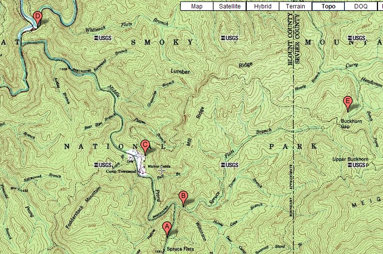
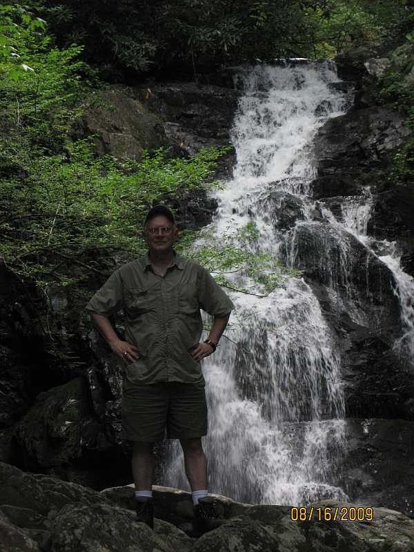
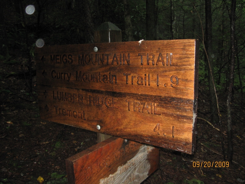
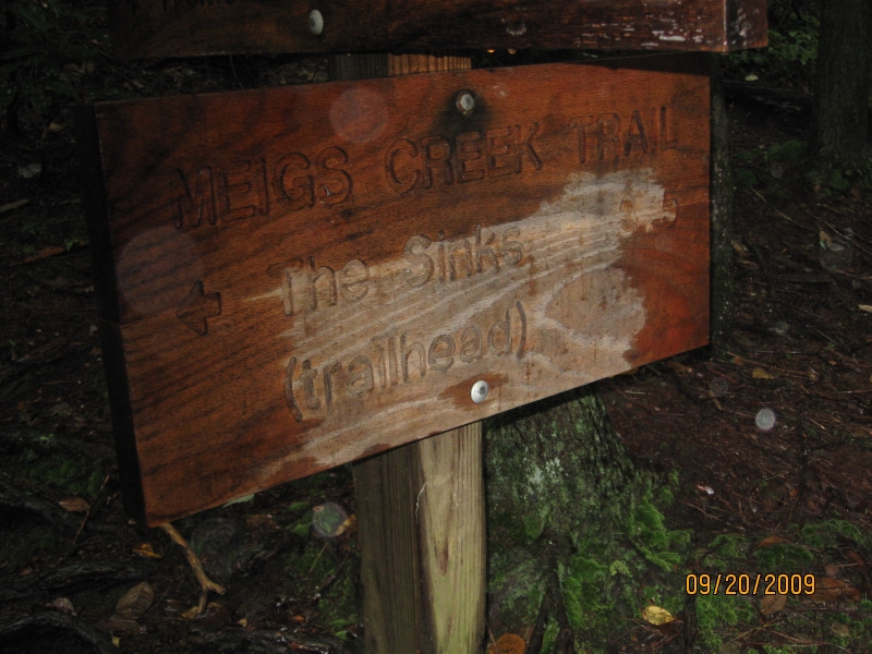
The trailhead is at point A on the Middle Prong of the Little River, across the Middle Prong from Tremont Road.  The trail follows the Spruce Flats Branch upstream and terminates at Buckhorn Gap - point E.  At Buckhorn Gap, the trail intersects with the Lumber Ridge Trail, the Meigs Mountain Trail, and the Meigs Creek Trail.  The chief attraction on the trail is Spruce Flats Falls at point B.  An alternative to get to the Spruce Flat Falls is the Spruce Flat Falls Trail from Tremont with the trailhead at point C.

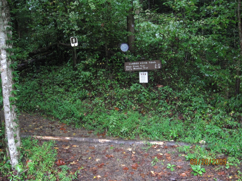
The trail is unmarked and is not maintained by the Park Service.  It does not appear in any of their official publications.

On topographic maps, the trailhead at point A appears to be about 1.5 miles upstream on the Middle Prong from the Great Smoky Mountains Institute at Tremont at point C.  There is no parking area or signage at the trailhead, so the trailhead can be hard to find.  See below for my problems in finding the trailhead.

The Townsend Y at point D is the usual landmark when entering this portion of the park.  It's a couple of miles from the Y to Tremont at point C.  Point B is Spruce Flats Falls, and I have hiked to the falls before on the trail from point C at Tremont.  The hike to the falls from point C is only about a mile, but it's pretty steep.  The hike to the falls from point A is even shorter - maybe a quarter mile or less.  But hiking from point A involves a crossing of the Middle Prong, which can be ankle deep or waist deep depending on how high the creek is running.

Map of Unmarked Spruce Flats Falls Trail

25 Jul 2009

I actually never found the trailhead, so the hike was a failure unless you don't count tromping up and down the Middle Prong for a couple of hours and having a great time as a failure.

Point A is the trailhead for the old unmarked trail, and that's the place I couldn't locate.  I have seen the old unmarked trail when I was at point B at the falls, and also I have seen the old unmarked trail when I was at point E at Buckhorn Gap.  I guess I'm either going to have to go back to the falls or to Buckhorn Gap and hike down the old unmarked trail to its origin in order to locate the old unmarked trailhead at point A.

An alternative way to hike most of the old unmarked trail for most of its length would be to hike from Tremont to the falls on the Spruce Flats Falls Trail, and then continue on the old unmarked trail to Buckhorn Gap.  But that route would not serve the function of locating the old trail head.


To avoid the day being a complete bust as far as pictures, I experimented for the first time with using my digital camera to make very brief movie.  The movie is of a small, unnamed cascade on the Middle Prong.  It's one of probably hundreds or thousands of such little cascades on the Middle Prong.  This one is about 3 feet high.  The far bank of the Middle Prong is where I was looking for the elusive unmarked trailhead.

Unnamed cascade on the Middle Prong of the Little River from Jerry Bryan on Vimeo.


16 Aug 2009

I went back to Spruce Flats Falls at Point B by hiking from Tremont at point C to the falls, and then I followed the old unmarked trail down Spruce Flats Branch to the old trailhead at point A.  So I found the trailhead.  Yea!  And I found somebody to take my picture at the falls.

Jerry at Spruce Flats Falls Trail

Since I was back at the falls, I made a little video.  I think the video gives a better sense of the falls than does a still picture.

Spruce Flats Falls from Jerry Bryan on Vimeo.


As you follow the old unmarked trail down to the trailhead, you are really following Spruce Flats Branch down to its mouth where it empties into the Middle Prong.  In fact, there is not much of a trail, and to a certain extent you are bushwhacking your way through the woods.  Fortunately, it's less than a quarter mile.

Along the way, you pass a second but smaller falls.  This picture is of the lower falls from the side as you pass it.

Spruce Flats Lower Falls

Video of the lower falls from the trail at the side of the falls.  This is basically the same view as the still picture immediately above.  At one point, I tried to move the camera to capture a little bit of the upper cascade of the lower falls, but you still can't see much of the upper cascade.

Spruce Flats Falls (lower falls, side view), Great Smoky Mountains National Park, 16 Aug 2009 from Jerry Bryan on Vimeo.


Video of the lower falls from the trail at the front of the falls.  At this point, I was standing almost all the way down at the Middle Prong, with the Middle Prong at my back.

Spruce Flats Falls (lower falls - front view), Great Smoky Mountains National Park, 16 Aug 2009 from Jerry Bryan on Vimeo.


20 Sep 2009

On this occasion, I hiked 4.1 miles from Tremont (point C) to Buckhorn Gap on the Lumber Ridge Trail (point E), 3.8 miles from Buckhorn Gap to Spruce Flats Falls (point B) on the unmarked Spruce Flats Falls Trail, and 1.0 miles from Spruce Flats back to Tremont (point C) on the marked Spruce Flats Falls.  It had been raining for a week and all the creeks were running very high.  So I didn't want to risk a crossing of the Middle Prong.

The trail terminology is confusing.  The old and unmarked Spruce Flats Falls Trail trailhead is near Tremont Road about a mile from Tremont itself.  Tremont Road parallels the Middle Prong of the Little River, and the trailhead is across the Middle Prong from the road and is at the mouth of Spruce Flats Branch.  A fairly small child could stand in the road and throw a rock across the Middle Prong and into Spruce Flats Branch, but the crossing of the Middle Prong can be difficult if the creek is running high.  If you can make it across the Middle Prong, it's only about ¼ mile up to the falls, but there is so little trail that it can feel like bushwhacking.  From the falls, it is another 3.8 miles or so to Buckhorn Gap.

A more typical route to the falls is from Tremont up a marked and maintained trail perversely called the Spruce Flats Falls Trail.  This trail is only 1.0 mile long.  It is maintained by the Tremont Institute rather than by the National Park, so it does not appear on trail maps.  Upon reaching the falls on this trail, you could return on the trail to Tremont, you could go downstream from the falls for about ¼ miles the Middle Prong to get onto Tremont Road, or you could go the 3.8 miles or so to Buckhorn Gap on the old unmarked trail.

Trailhead for Lumber Ridge Trail

It rained steadily but not too hard throughout the hike, except that a few times it rained very hard.  The rain was not a problem on the Lumber Ridge Trail.  But it made the old Unmarked Spruce Flats Falls Trail difficult at times.  It wouldn't take much work to get the trail back into pretty good shape.  The trail surface itself is fairly wide and smooth.  But the rain made things pretty slick and there was a lot of foliage and downed trees on the trail.  Getting through the wet foliage and over or under the downed trees was a bit of an adventure at times.  Also, the trail follows Spruce Flats Branch, and there are a lot of stream crossings.  It's a small stream and under normal circumstances the crossings would be easy.  But with all the rain, the stream was running high and some of the crossings were a little more difficult than anticipated.


Trail signs at Buckhorn Gap.  The signs are wet because of the rain.

Trailhead for Lumber Ridge Trail Trailhead for Lumber Ridge Trail

This video relates to the Lumber Ridge Trail rather than to the Spruce Flats Falls Trail.  But the route I took was Tremont to Buckhorn Gap via the Lumber Ridge Trail, followed by returning to Tremont via the Spruce Flats Falls Trail.  The video was taken at the crest of Lumber Ridge at the highest point on the Lumber Ridge trail.  But the trail crosses a saddle point or sort of a gap in Lumber Ridge.

Lumber Ridge, Great Smoky Mountains National Park from Jerry Bryan on Vimeo.


This video is a 360 degree panoramic view of Buckhorn Gap.  Buckhorn Gap is the junction of four trails - Lumber Ridge, Meigs Creek, Meigs Mountain, and Spruce Flats Falls.  The first three trails are marked and are maintained by the National Park.  But the Spruce Flats Falls Trail is unmarked and is not maintained.

Buckhorn Gap, Great Smoky Mountains National Park from Jerry Bryan on Vimeo.


Return to Jerry's Home Page

This page last edited on 11 Jun 2011.