| Jerry Bryan's Web Pages | |
Jerry's Kayaking Page |
|
This is the beginnings of a kayaking log, but very few of my little excursions are logged so far (and they are indeed little excursions). I am strictly a flat water kayaker, no white water for me at this point.
I'm including a JPG file, a GPX file, and a KMZ file when I have them available. The GPX file comes from the same Garmin GPS device that I use for hiking. I convert GPX files to KMZ at http://www.gpsvisualizer.com/map_input?form=googleearth. In order to make the JPG, I load the GPX file into Google Earth and do a screen capture.
- I'm making no particular attempt to get the GPX file to load into any particular software, I'm making it available for download. Your browser and operating system probably could be set up to open it into an application of your choice but it's hard to set up a Web page so that it opens a GPX file reliably into something like Google Maps or Google Earth.
- The KMZ file is set up so that it opens in Google maps in any one of four formats: Satellite, Hybrid, Terrain, and Topo. To create that effect, I'm using a very useful free site called mappingsupport.com. I suppose it's possible that the site could quit working at any time. The KMZ file can also be downloaded and hence can be processed as you wish, just as the GPX file can be downloaded and processed as you wish.
I'm not making a KMZ file available for download. I think that most any program that can read a KMZ file can also read a KMZ file. A KMZ file is really just a zipped copy of a KMZ file. Indeed, you can rename a KMZ file as a ZIP file and open it with any software that can process ZIP files. If you do so, you will see the KMZ file inside inside the ZIP file.
|
2 Aug 2014 |
3.07 miles |
1:37 hours |
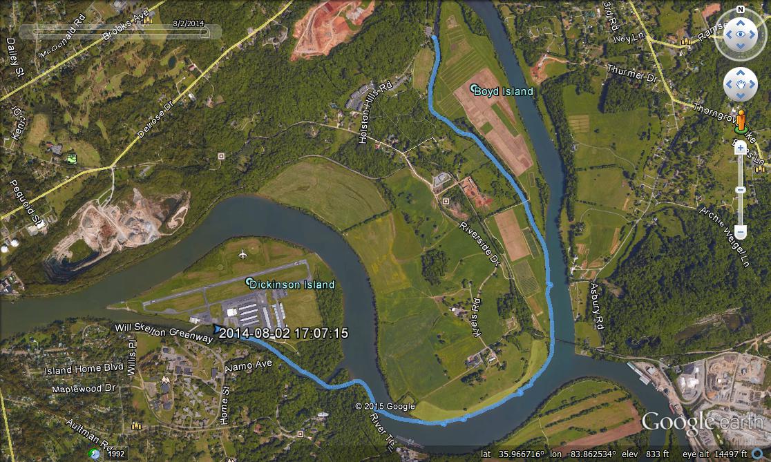
Holston River. Holston Park to Dickenson IslandHolston Park is on a small channel of the Holston River at Boyd's Island. The small channel connects up with the main Holston River which soon merges with the French Broad River to form the Tennessee River. The Tennessee River then passes Ijams Park which is on the south bank of the Tennessee River and the kayaking route follows a small channel of the Tennessee River between Dickenson Island and the south bank. Knoxville's Downtown Island Airport is on Dickenson Island, and the put-in point for boats is on the airport property across the small channel from Ijams Park. |
|
20 Jul 2016 |
6.1 miles |
3:14 hours |
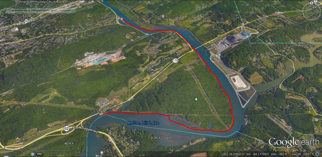
Clinch River. Rowing Club to Haw Ridge Park boat rampThe Rowing Club is a well known site along the Clinch River in Oak Ridge. The boat ramp at Haw Ridge Park is about 6 miles downstream. The route passes the Bull Run Steam Plant whence the river makes a sharp bend right (to the west) towards the Haw Ridge Park. |
|
16 Sep 2016 |
2.6 miles |
2:14 hours |
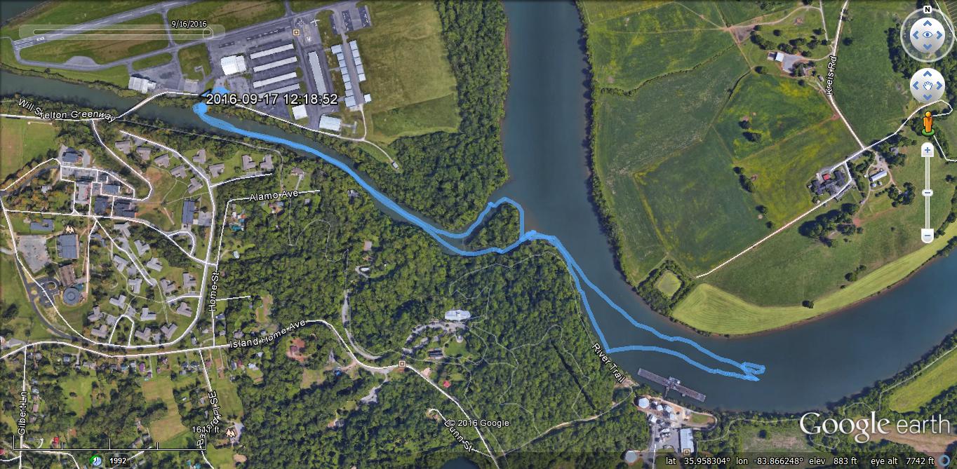
Tennessee River. Downtown Island Airport to Ijams Park and beyondThis is an area I go frequently, usually by myself. It's an easy, short paddle. This time, I went with a group of people, leaving at sunset to see a munificent harvest moon. |
This page last edited on 25 Apr 2017.