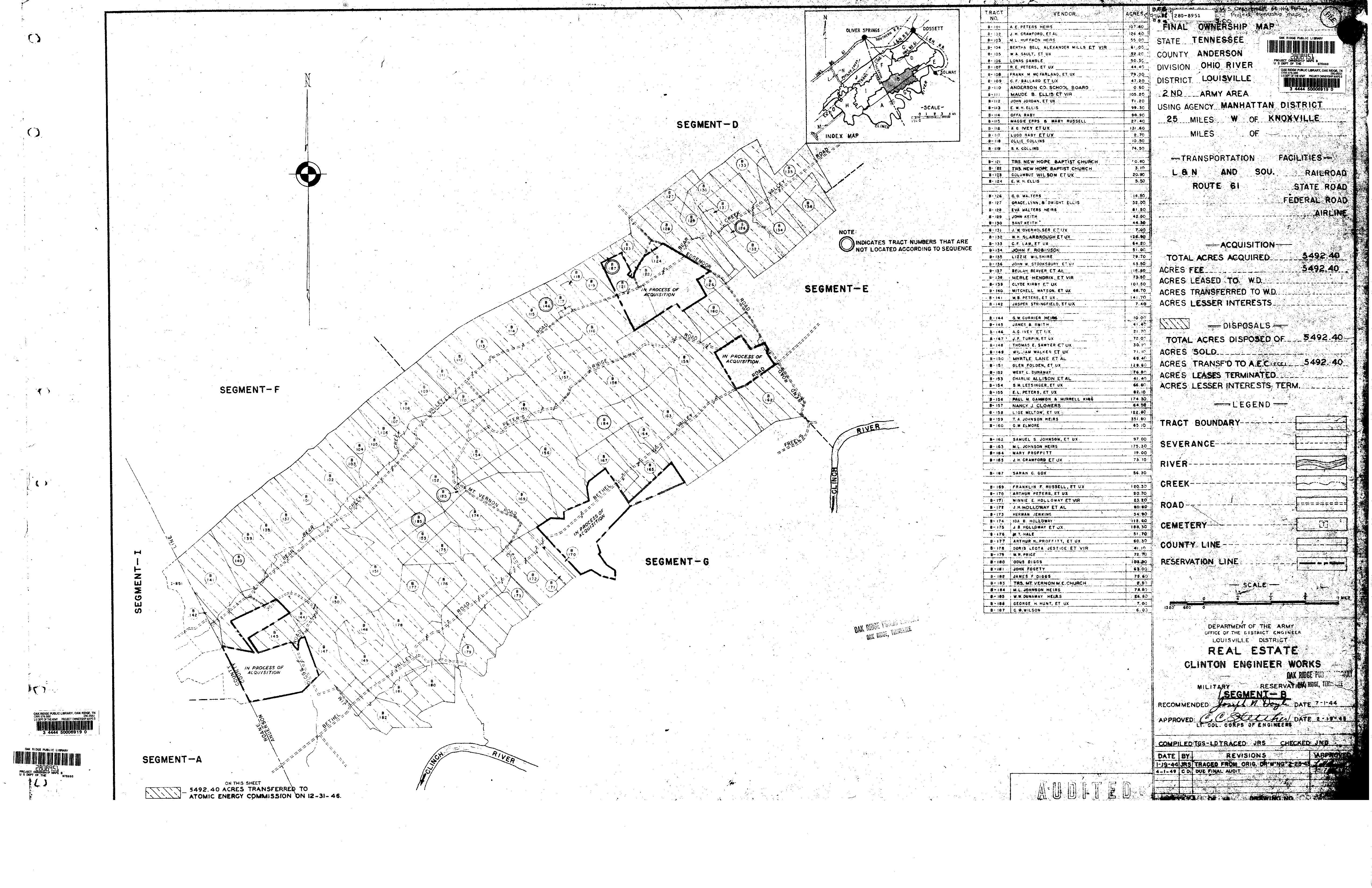
Section B17, Army Corp of Engineers Maps, Anderson County, Tennessee, 1942.
This is primarily the Bear Creek Valley area plus a part of the Scarbrough community. The northern boundary of the parcels largely follows the crest of Pine Ridge. The parcels at the southern part of the map tend to straddle Bethel Valley Road. Parcels between Bethel Valley Road and the Clinch River to the south are included in Section G17 which is a separate map.
Click on the map to see it full size in your browser.