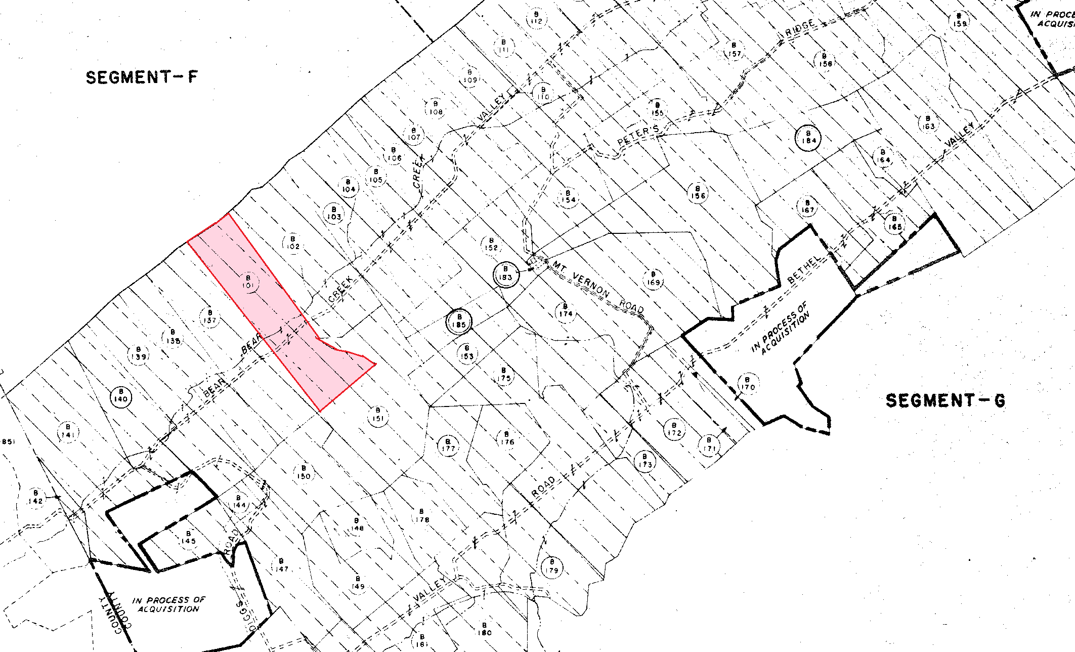
This is an extract from one of the 1942 Army Corps of Engineers maps of the land that was taken to build the secret city of Oak Ridge during WWII. Alva's land was parcel B101 on the Army map. The wartime code name for the area was the Kingston Demolition Range or KDR, so these maps are often called KDR maps. The repository for the KDR maps is the National Archives office in Atlanta.
The western boundary of this particular map is the line between Roane County and Anderson County, with all the parcels on the map being in Anderson County. Starting from the west, Alva's land is the sixth parcel from the Roane County line.
There is no topographic information on the KDR maps. There is a key on the map that provides the name of the owner for each parcel. The key is not displayed in this extract. The precise location of each parcel on the map in terms of modern GPS coordinates can be determined by such things as roads and the boundary line between Roane County and Anderson County.
In addition, the map can be cross referenced against historical deeds for the parcels. We know from the deeds that the northern boundary of Alva's land was the top of Pine Ridge. In fact, Pine Ridge was the northern boundary of many of the parcels on this map. Therefore and as an example, we can use Google Maps to determine that the GPS coordinates for the place where the Roane County line crosses the peak of Pine Ridge are 35.96511, -84.30480. In turn, those are the coordinates of the northwest corner of parcel B141 on the map.